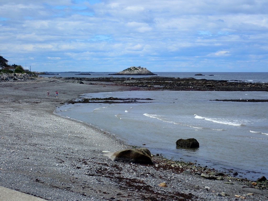
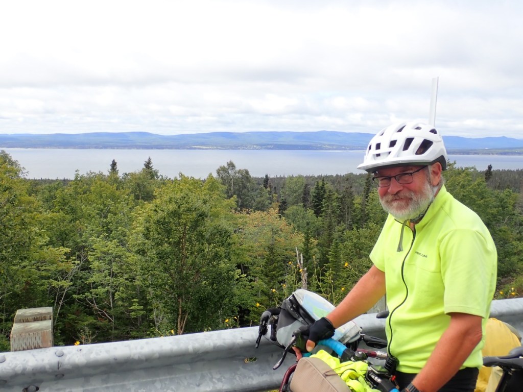
On Saturday morning, August 19, 2023, we left our car at a Warm Showers home in Campbellton, New Brunswick, and rode across the bridge to Quebec to begin our bicycle ride around the Gaspee Peninsula. We completed our journey thirteen days later, on Thursday, August 31. Thirteen days with no fast-food restaurants and no chain motels, just small towns tucked into picturescque coves along the mouth of the St. Lawrence River and the Chaleurs Bay. I don’t even remember any traffic lights.
We had not a single flat tire. And the temperature was perfect for riding every day.
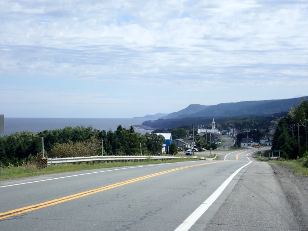
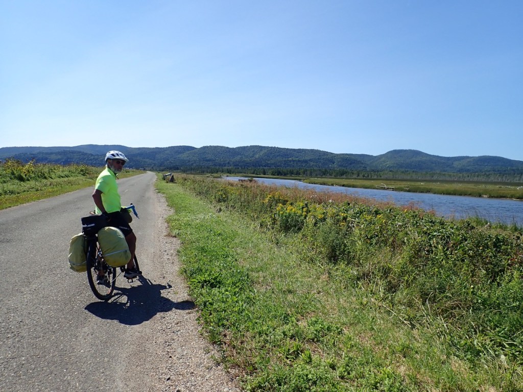
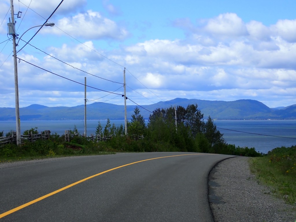
The Route Verte mostly follows Route 132 around the peninsula. We began by riding from the south shore to the north shore, which took three days.
DAY 1 – August 19, Saturday: 56 miles to Causapscal
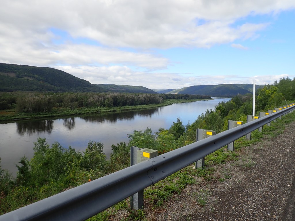
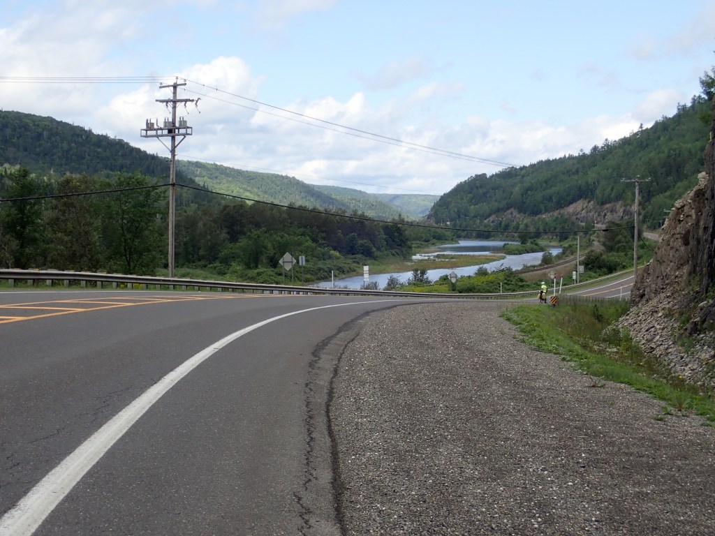
We rode along the Restigouche River for most of the day with easy, long uphills and a slight headwind.


DAY 2 – August 20, Sunday: 22 miles to Val-Brilliant
The only reason we had such a short day was because we’d ridden farther than planned the day before and we had a non-refundable reservation in St. Flavie for Monday night, just 40 miles away. Otherwise, we probably could have ridden all the way to St. Flavie in one day. But that was fine because the short day gave us plenty of time for a swim in Lac Saumon and a round of mini-golf. I got a hole-in-one but that still wasn’t good enough to beat Rob.
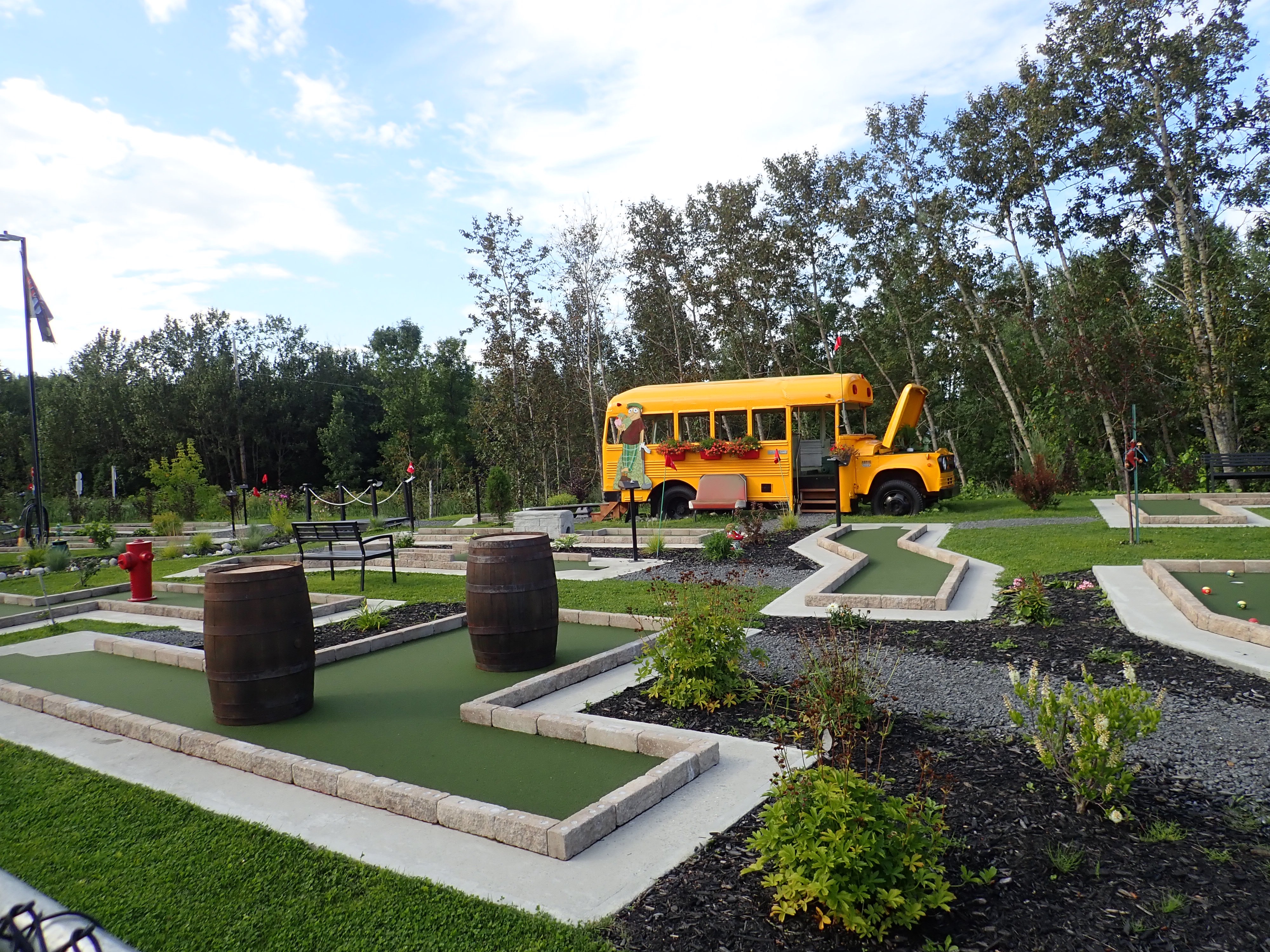

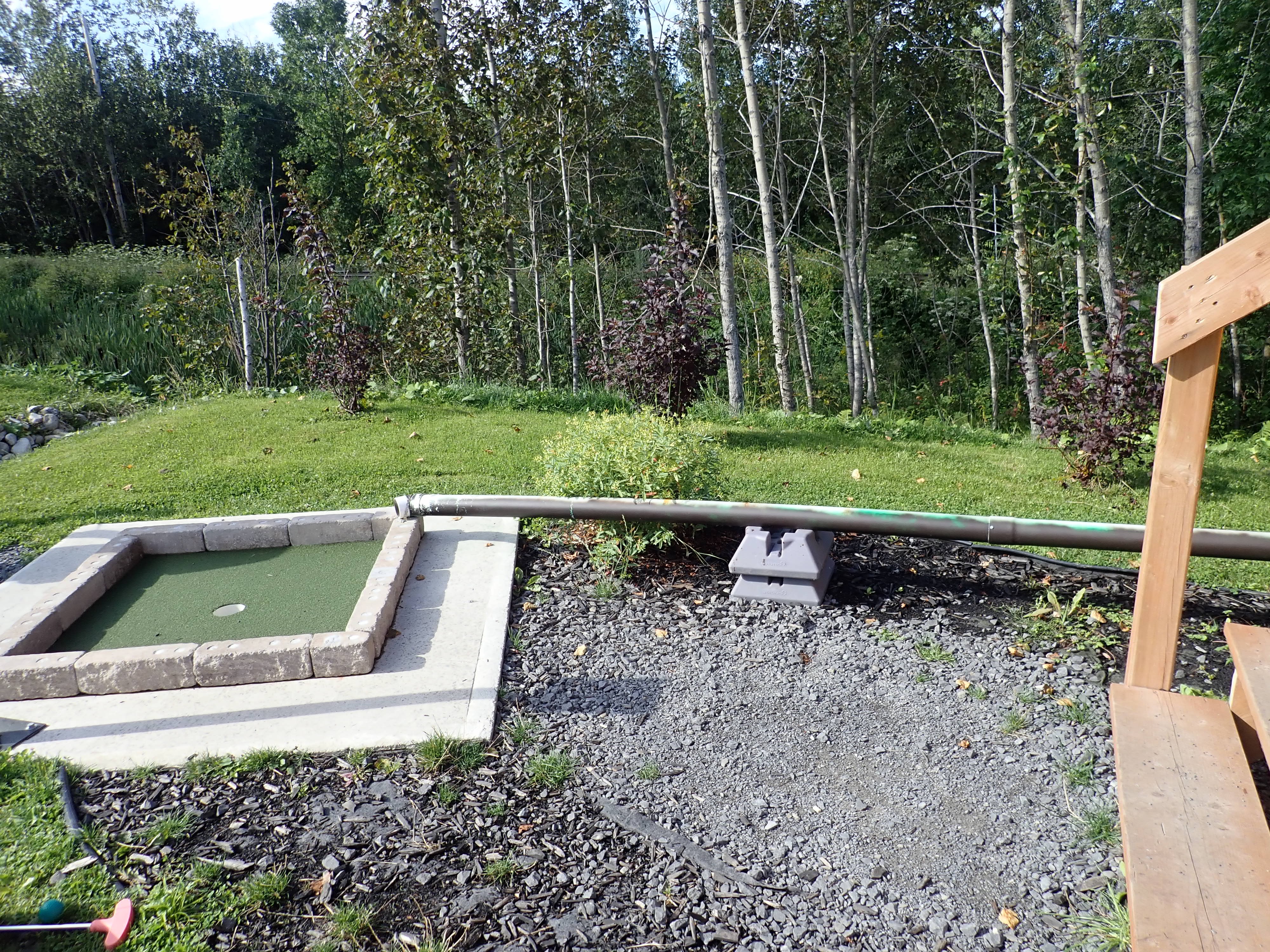
We’d never before played a hole of mini-golf inside a school bus. Tee off was inside the bus and the hole was outside.
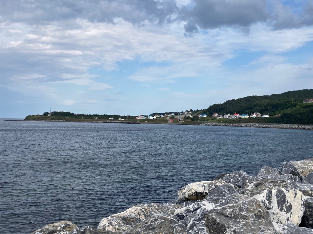
DAY 3 – August 21, Monday: 40 miles to St. Flavie
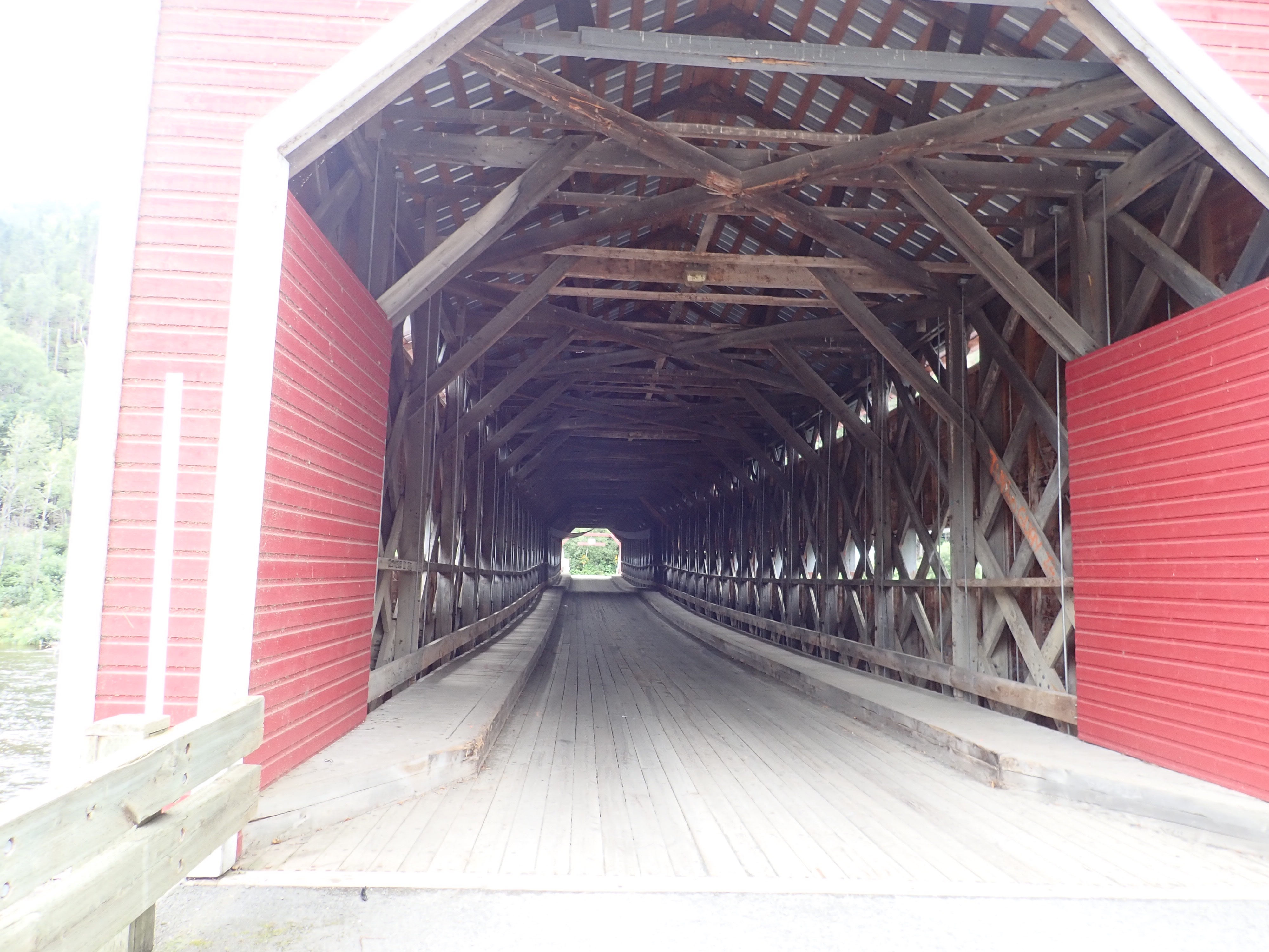
We had a challenging headwind and a few manageable hill climbs on our way to the northern shore of the peninsula. What was notable about the day was our accommodation for the night, which I’ll describe in a future post.

DAY 4 – August 22, Tuesday – 48 miles to Sainte-Félicité
Our itinerary called for 34 miles, but the riding was fast and easy along the coast with a lovely tailwind, so we did 48. We enjoyed the scenery as we sailed along.

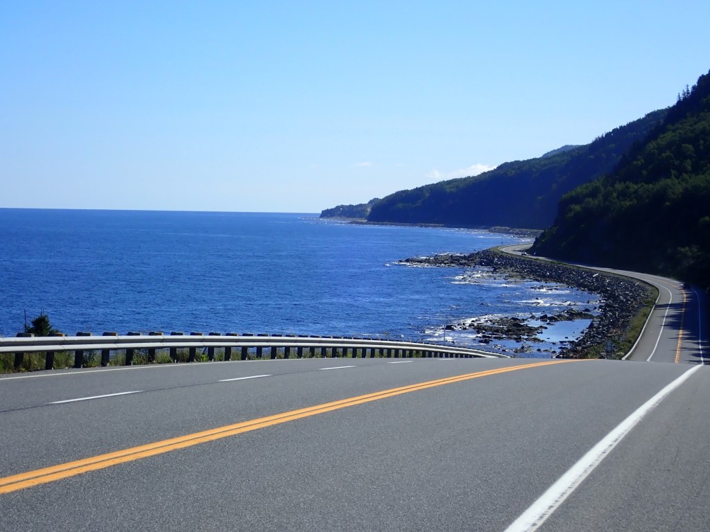
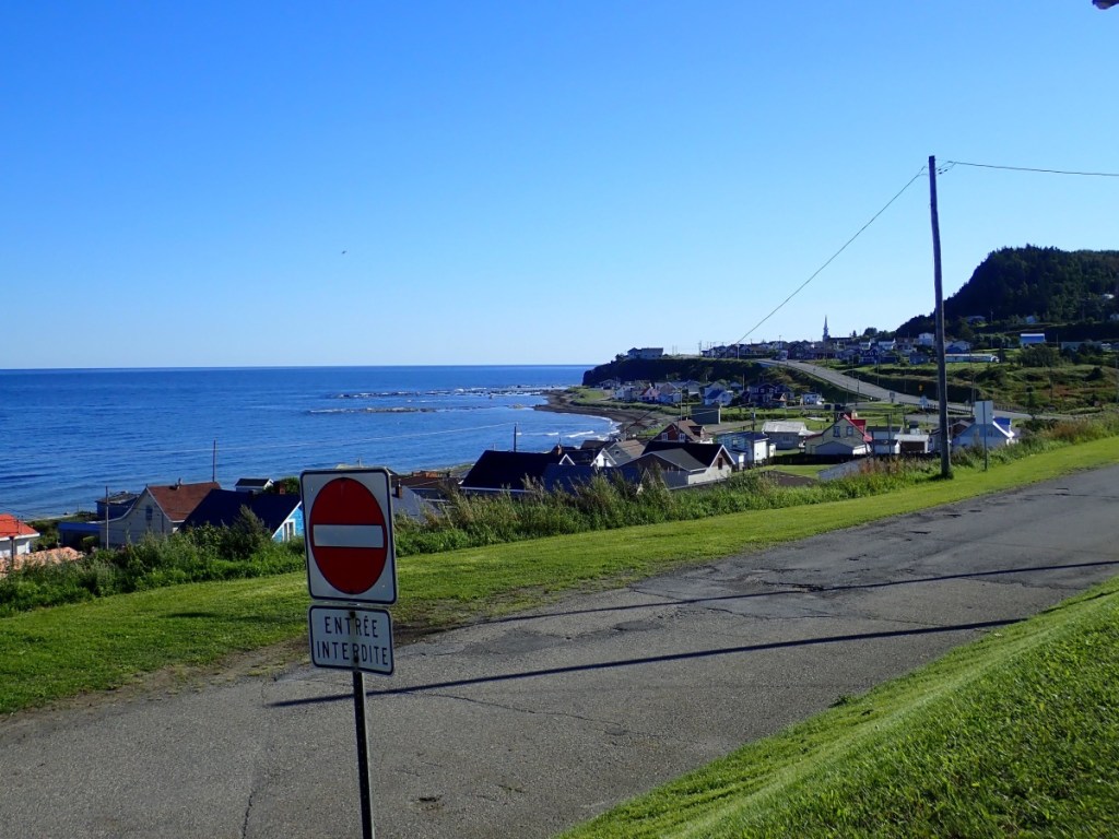
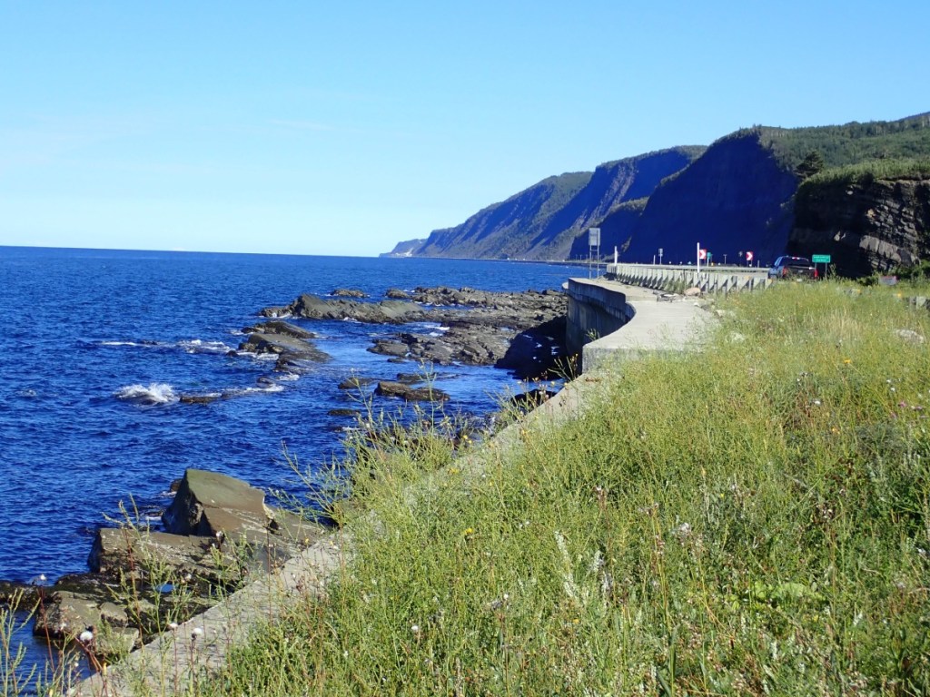
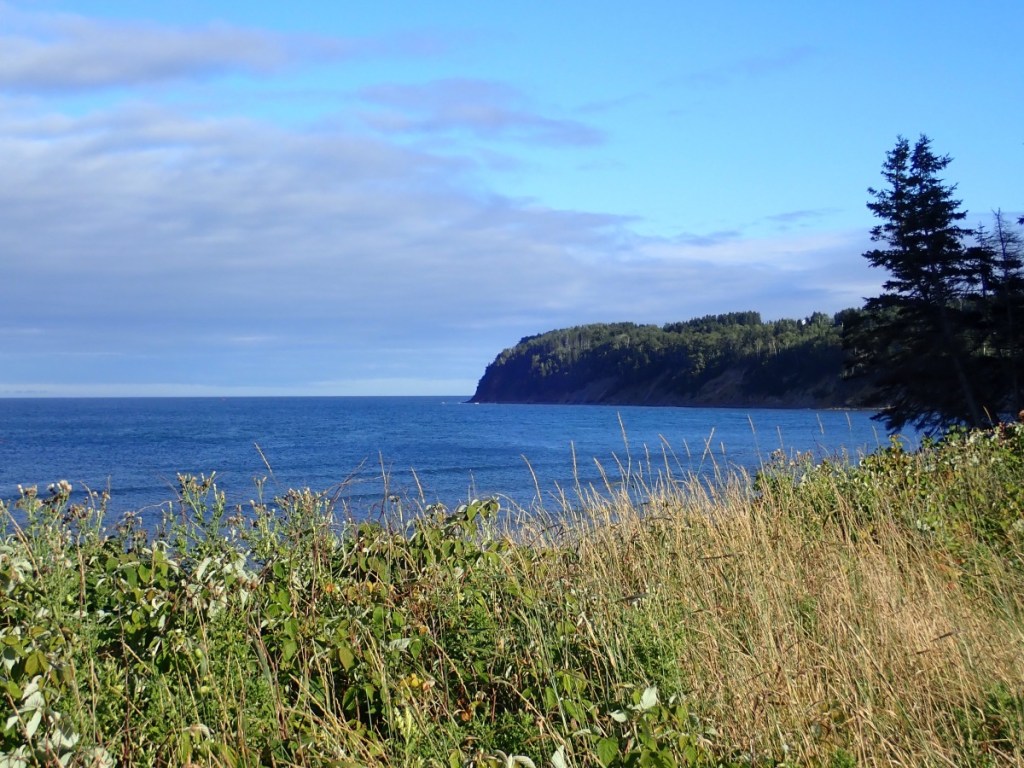
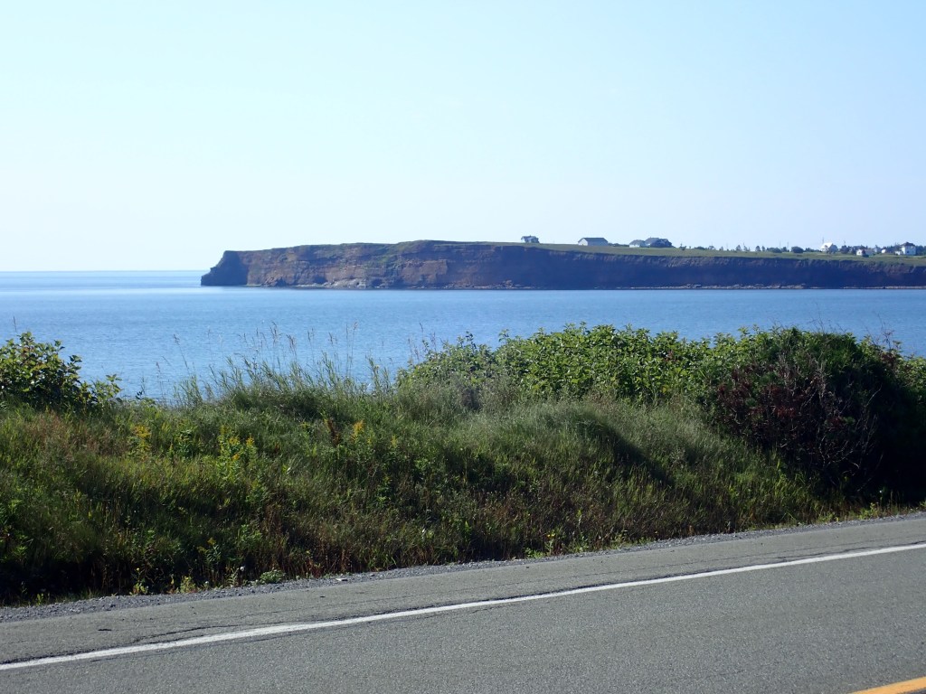
DAY 5 – August 23, Wednesday: 43 miles to Sainte-Anne-des-Monts
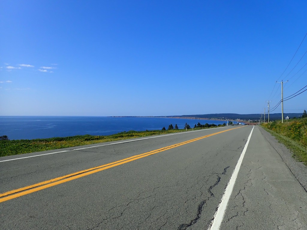
With a tailwind all day we mastered half a dozen climbs quite handily, riding in and out of small towns nestled into coves along the water.
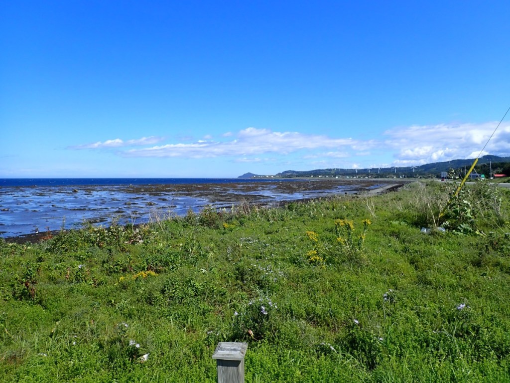


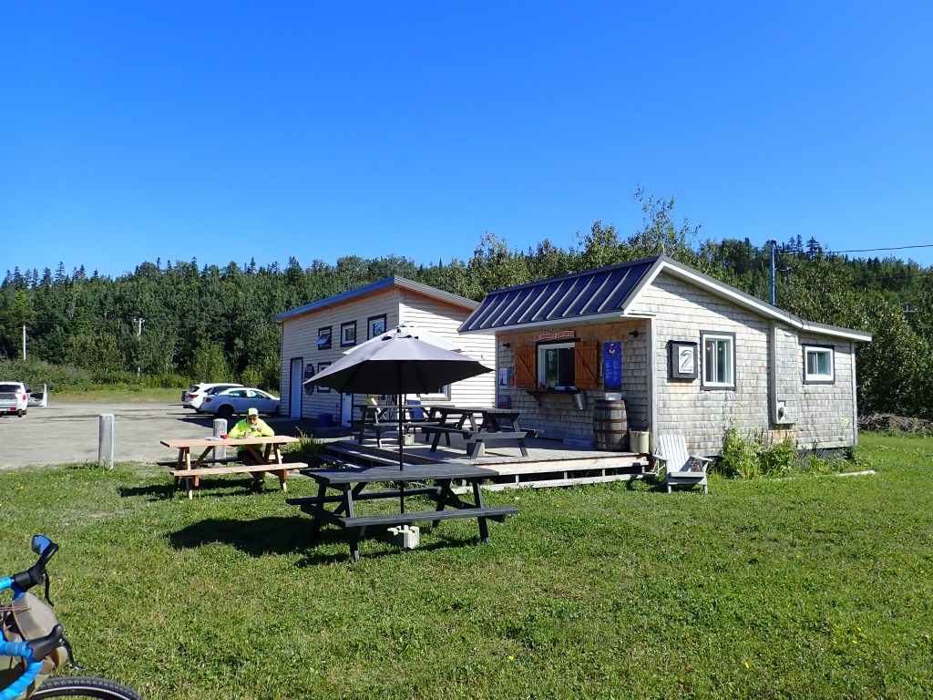
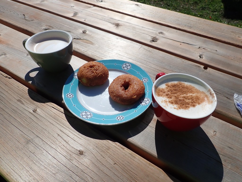
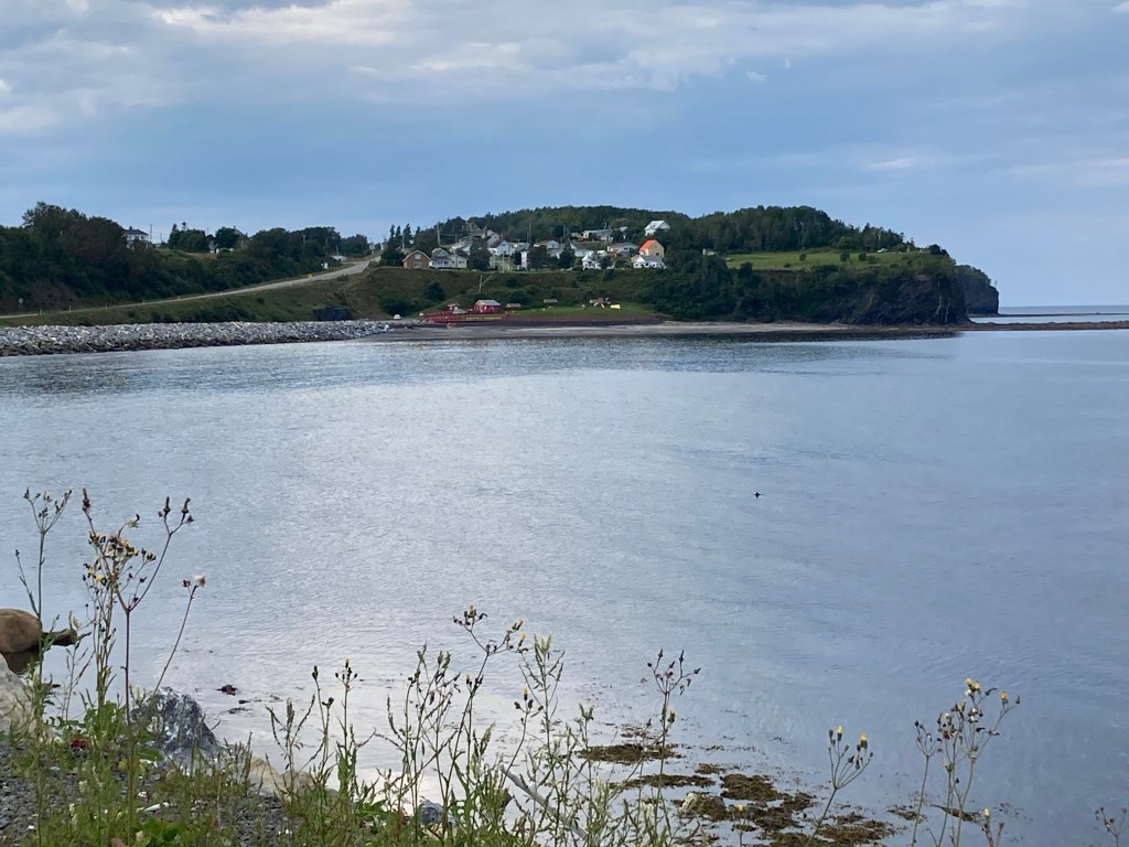
DAY 6 – August 24, Thursday – 57 miles to Madeleine Center
Out in the middle of nowhere, in the middle of the morning when it was time to take a break, I saw a sign for a cafe, and there it was, at the top of a hill. It was cold enough for hot chocolate (Rob) and a chai latte (me). I thought I’d order us a donut to share, but the proprietor told me they were on the house for cyclists so we each had one.
The riding was way easier than we’d anticipated. I felt a great sense of joy cruising on beautiful flat, fast stretches along the water’s edge. We easily mastered the small hills we encountered.

We arrived at our evening’s destination around 1:00 – way too early to stop.
Always, I let Rob call it a day when he says he’s done. He’s the one with lung disease and I know that prevents his muscles from getting the oxygen they need. But today, when Rob said his legs were tired, I wouldn’t hear it. He’d been keeping up just fine.
We had a beautiful fast ride to Madeleine Center with just one long climb at the end.

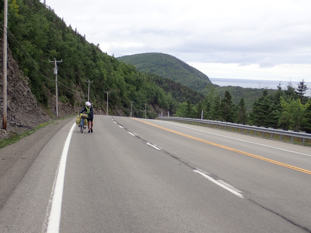
DAY 7: August 25, Friday: 31 miles to Saint-Yvon
This was the stretch with the toughest hills, and they kept coming. It was arguably our hardest day. When Rob said he’d had enough I didn’t argue, even though it was only 2:00.
Some cyclists we met told us about a cafe where we could camp for just ten dollars each, but with rain in the forecast we stayed in a very run-down motel instead. At least it overlooked the water. The cafe was only about a mile walk away.
It was a sweet little place. Like many “cafes” we encountered, there was no indoor seating. That was fine for us on a beautiful afternoon.

The ambience (Rob’s favorite word) was lovely, but the menu was rather limited: hot dogs, grilled cheese, muffins. At least there was beer.

I was still hungry so I ordered a second hot dog. Rob didn’t. But I happen to like hot dogs. Rob doesn’t. We both had ice cream sandwiches for dessert. I told Rob that ice cream sandwiches were something we often had for dessert when I was growing up. But we seldom have them now. Bud Light accompanied our lavish meal.
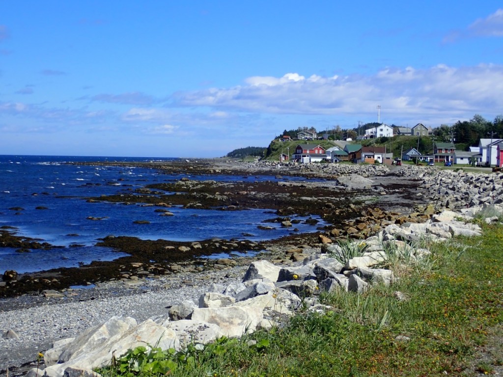
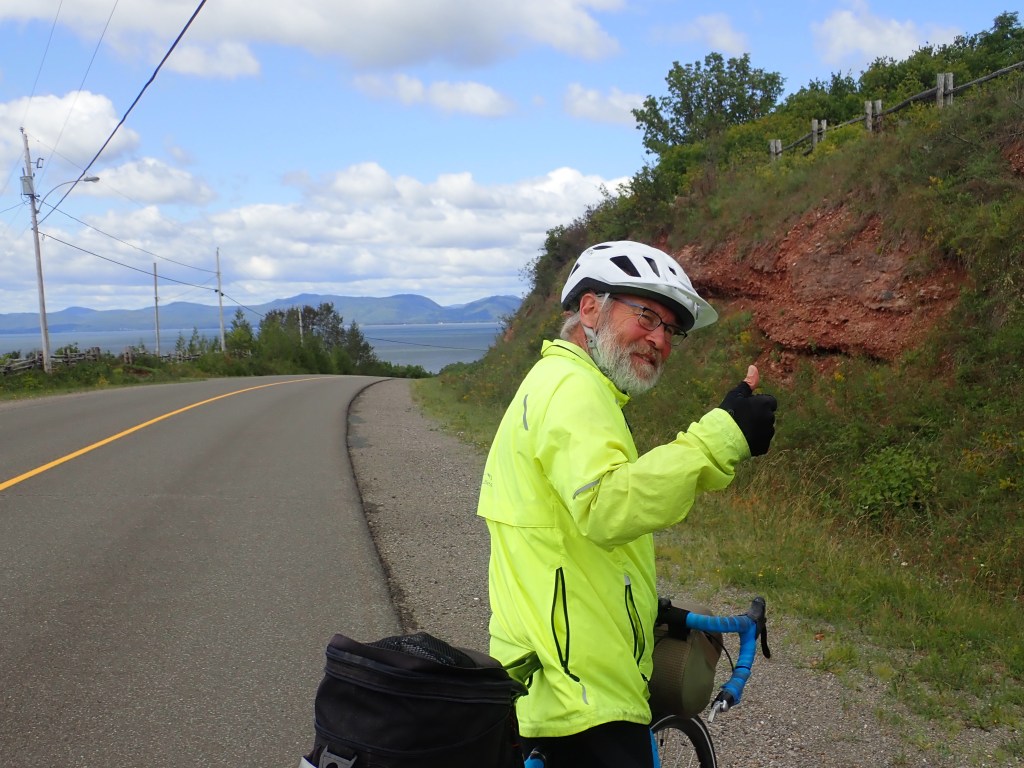
DAY 8 – August 26, Saturday: 41 miles to Forillon National Park
It was supposed to start raining overnight, but it didn’t. In fact we only had a couple bouts of rain during the day. Lots of hills to start, though, and we got to ride down one that was marked 15%.


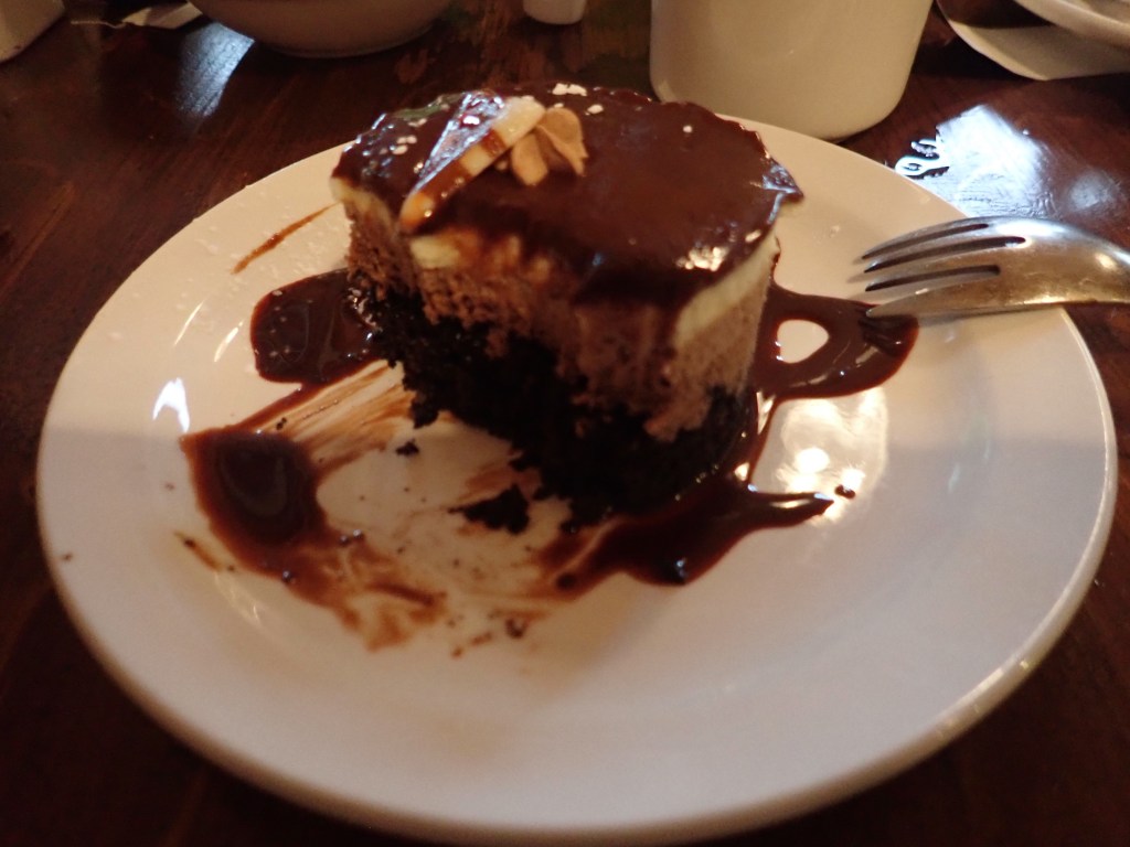
We arrived in L’Anse-au-Grillon just as we wanted a break from the rain and found a restaurant – The Café de L’Anse – that had been recommended by a woman in a visitor center we’d stopped at earlier. We were so thankful for that information as the food was incredible and we were able to linger as we waited for the rain to let up.
Unlike most people who take food photos, I only think about it after I’ve had a few bites. The shrimp roll and chocolate dessert were both phenomenal.

We left the hills behind us. Next came ten miles of flat, fast riding into the national park.
DAY 9 – August 27, Sunday: 51 miles to somewhere past Douglastown
We had a good riding day with a headwind or tailwind as we changed directions working our way around the tip of the peninsula. We had a few hills, one worth getting off our bikes and walking for a bit. We stopped in the town of Gaspé to visit the Musee de la Gaspesie to learn about the history of the region.
I have to admit that every day I felt completely filled with happiness, for the experience of witnessing this incredible landscape, and for having the physical strength to do so without the encumbrance of an automobile.

DAY 10 – August 28, Monday: 25 miles to Perce
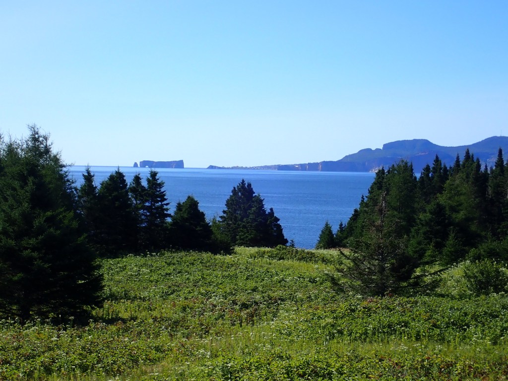
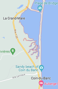
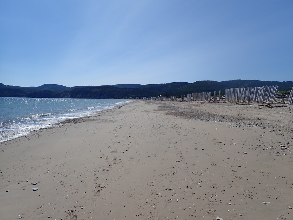
We only had 25 miles before arriving in Percé to see the famous rock, but what an adventure! The Route Verte took us on a road that bypassed the highway and it was pretty nice for a while, going out onto a deserted road with water on both sides. You can see it on the map pictured where the red dots are. There’s definitely a road on the map.
After a bit, the pavement ended and we were in deep sand. We saw another cyclist who said we’d have to walk our bikes but pointed to a house in the distance, saying, “It’s not too far. That’s where you get to pavement.”
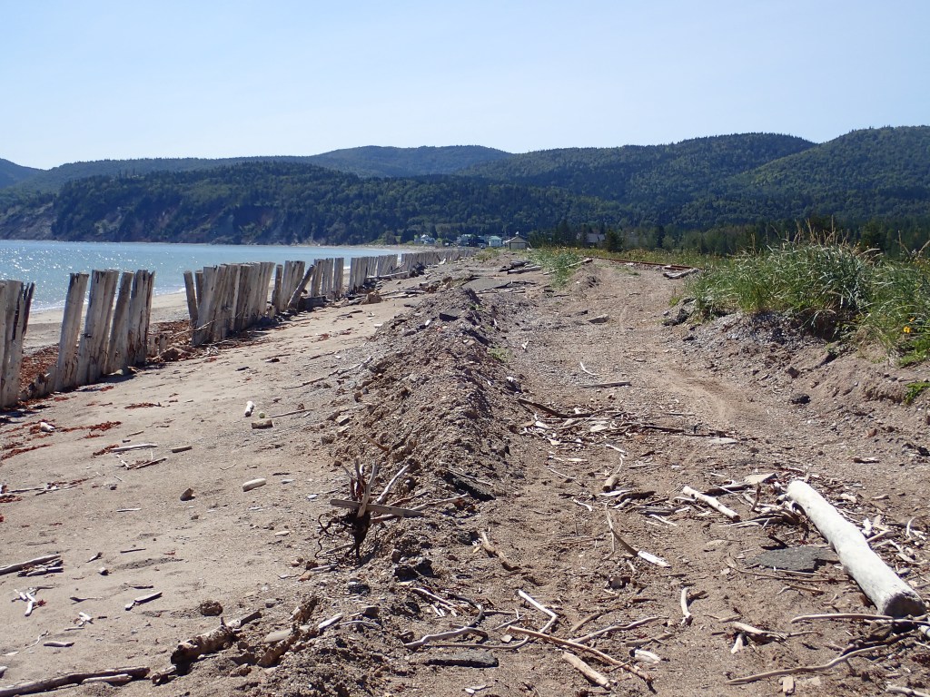
Past the remains of a wooden fence was the beach that looked like it would be much easier to walk on. Rob wasn’t convinced but after struggling for far too long, I followed wheel tracks through the wooden pillars onto the beach. It was much more pleasant walk.
Back on pavement we were in the almost nonexistent town of Coin-du-Banc. This is where we made the decision to strike out on our own off the Route Verte and found ourselves on the stunning 17% downhill into Percé.
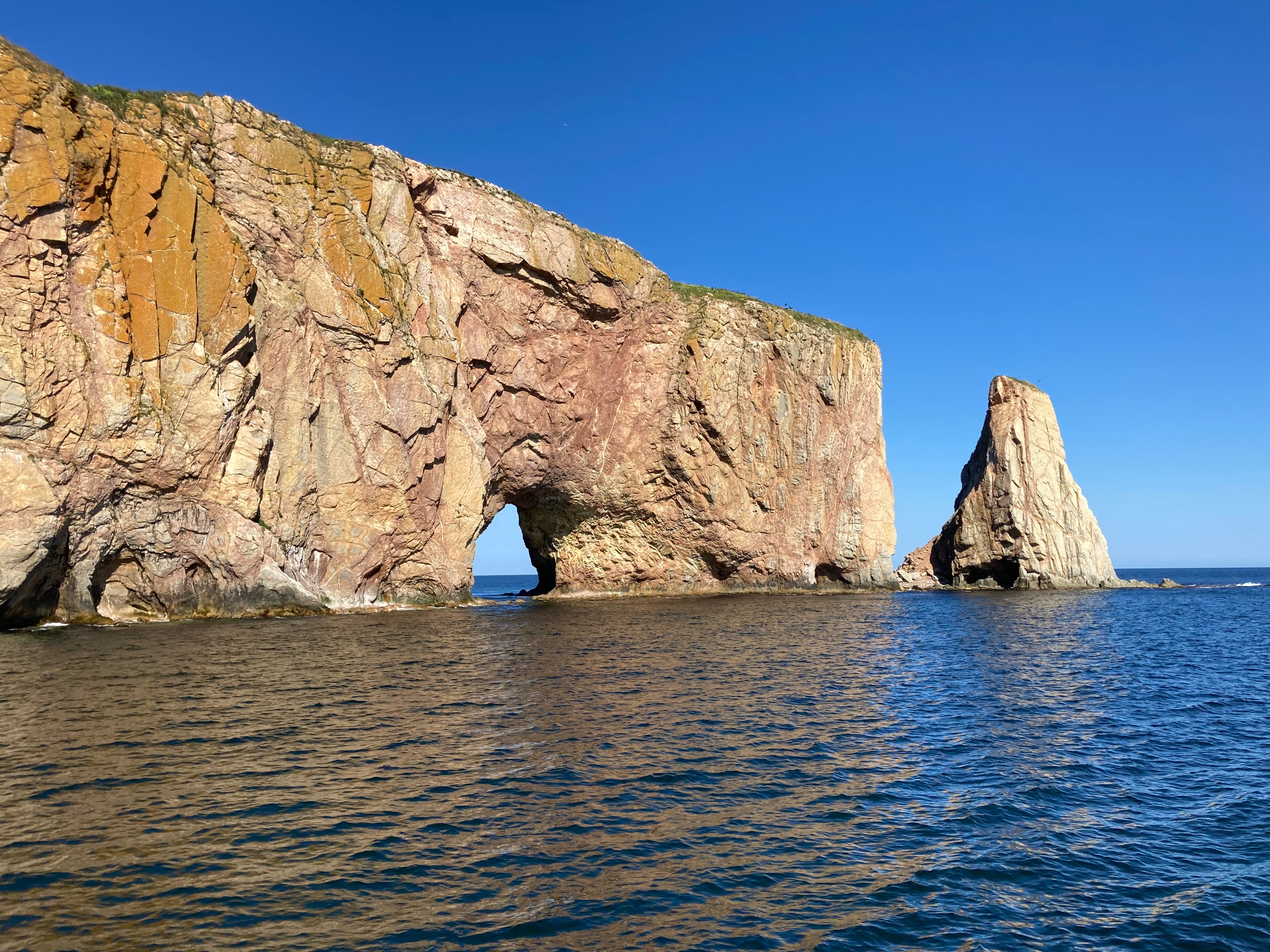
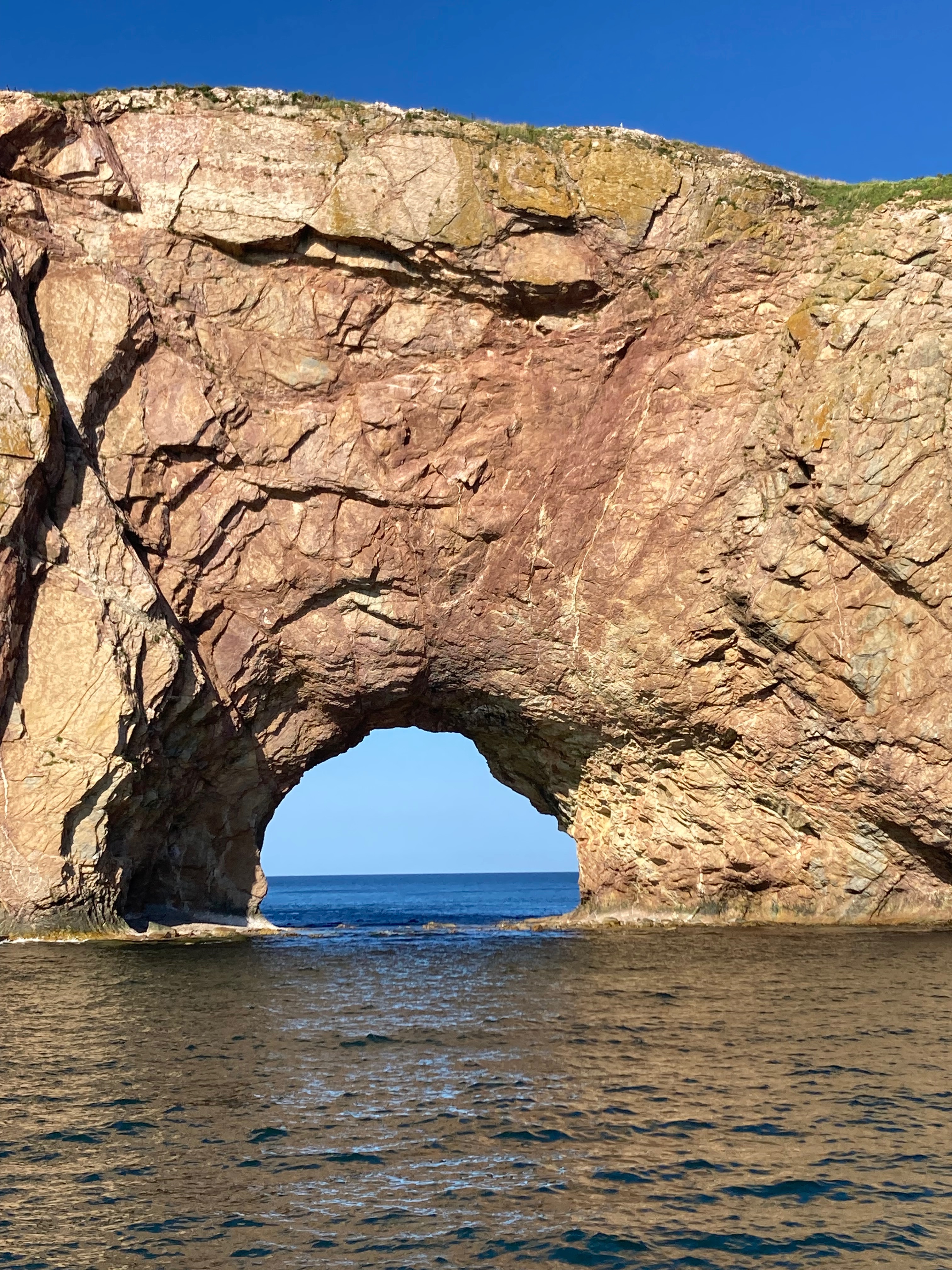
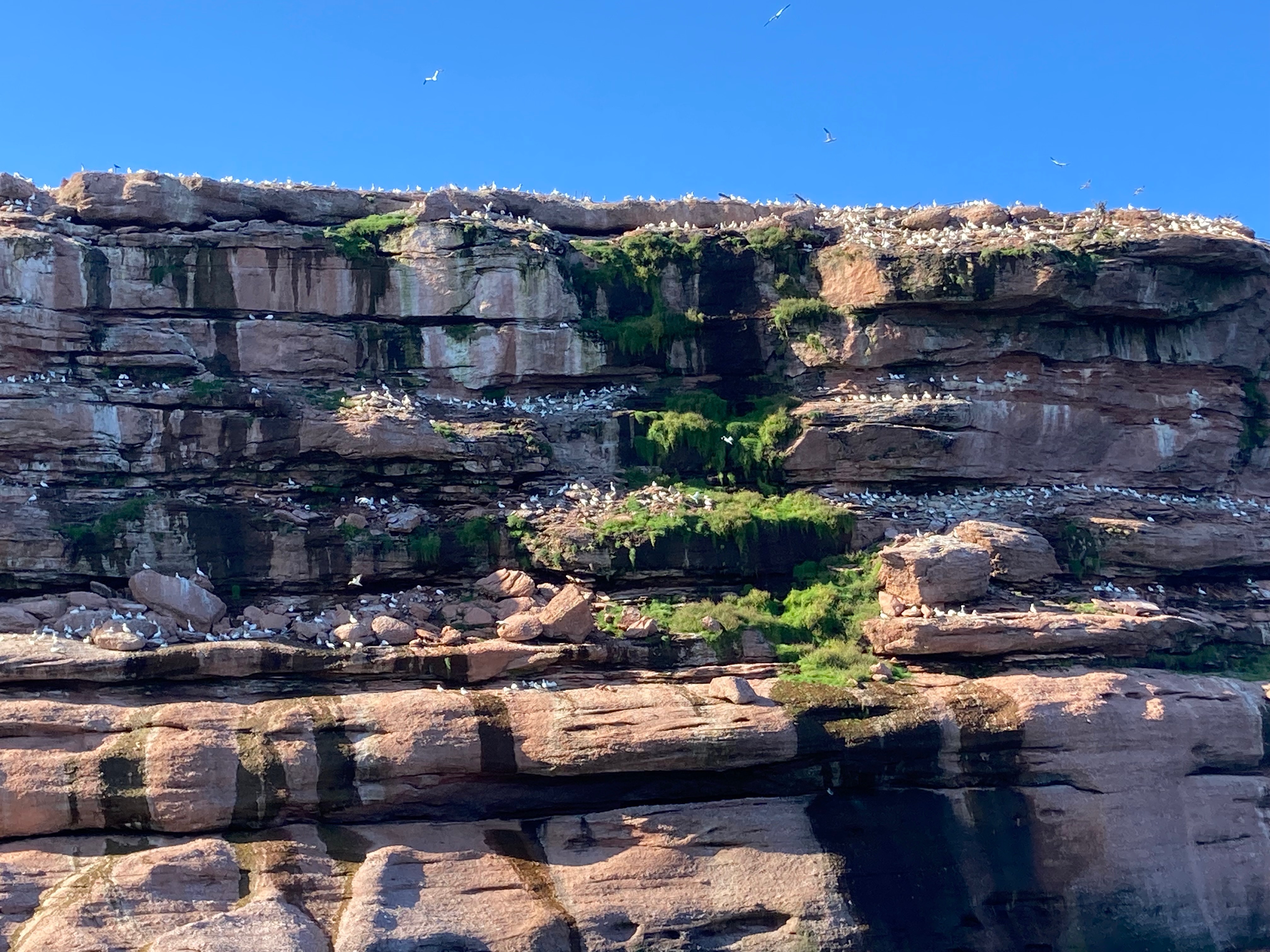
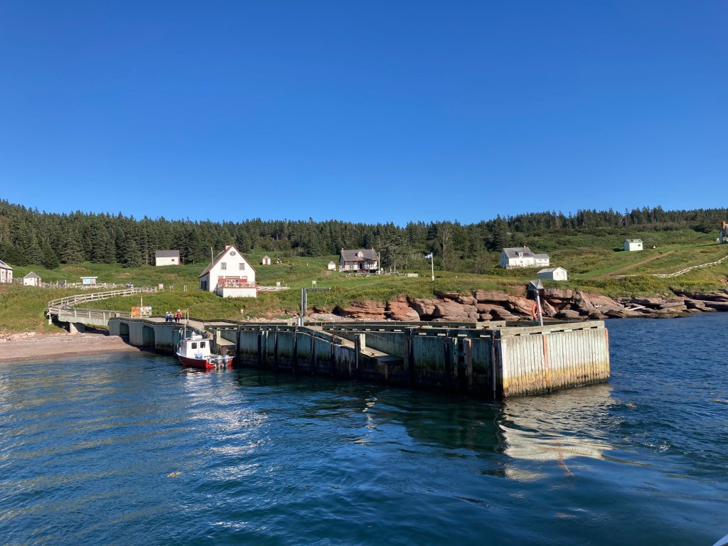
Then we played tourists in the only tourist town we encountered on this trip. Because this was the tail end of the season, we were able to purchase tickets for the boat ride around Perce Rock and Bonaventure Island at the last minute. We arrived in town early enough to catch the 1:30 boat, which would have allowed us to get off on the island and go for a hike to a gannet colony. But we weren’t in the mood to hurry or hike, so we took the 3:00 tour. We decided we wouldn’t mind an excuse to return on a road trip someday and visit the island then.
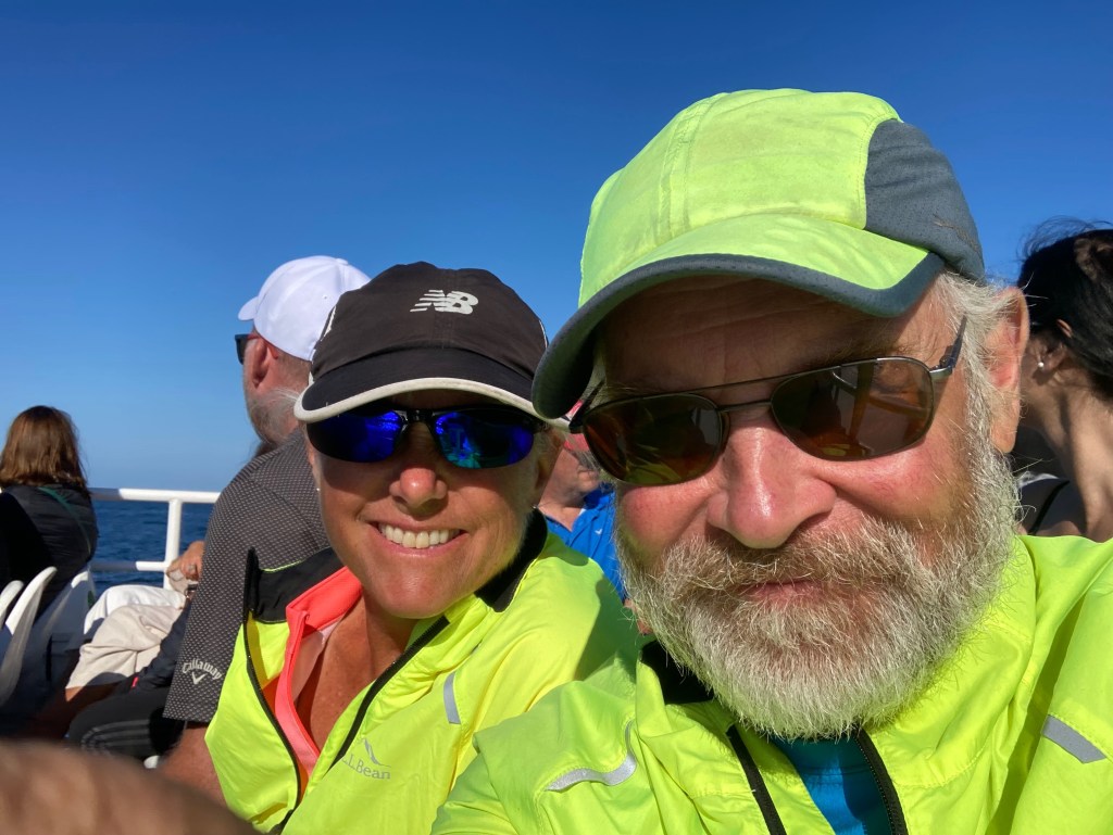
The boat trip lasted 90 minutes. Although we had trouble hearing the captain when he spoke in English and the crew member on our deck yelled excited exclamations in French which we couldn’t understand, it still was a great trip.
First we went around the rock. Actually, you can’t go completely around the rock because at low tide you can walk out to it. But we saw signs saying don’t do it, because rocks can come tumbling down at random times.

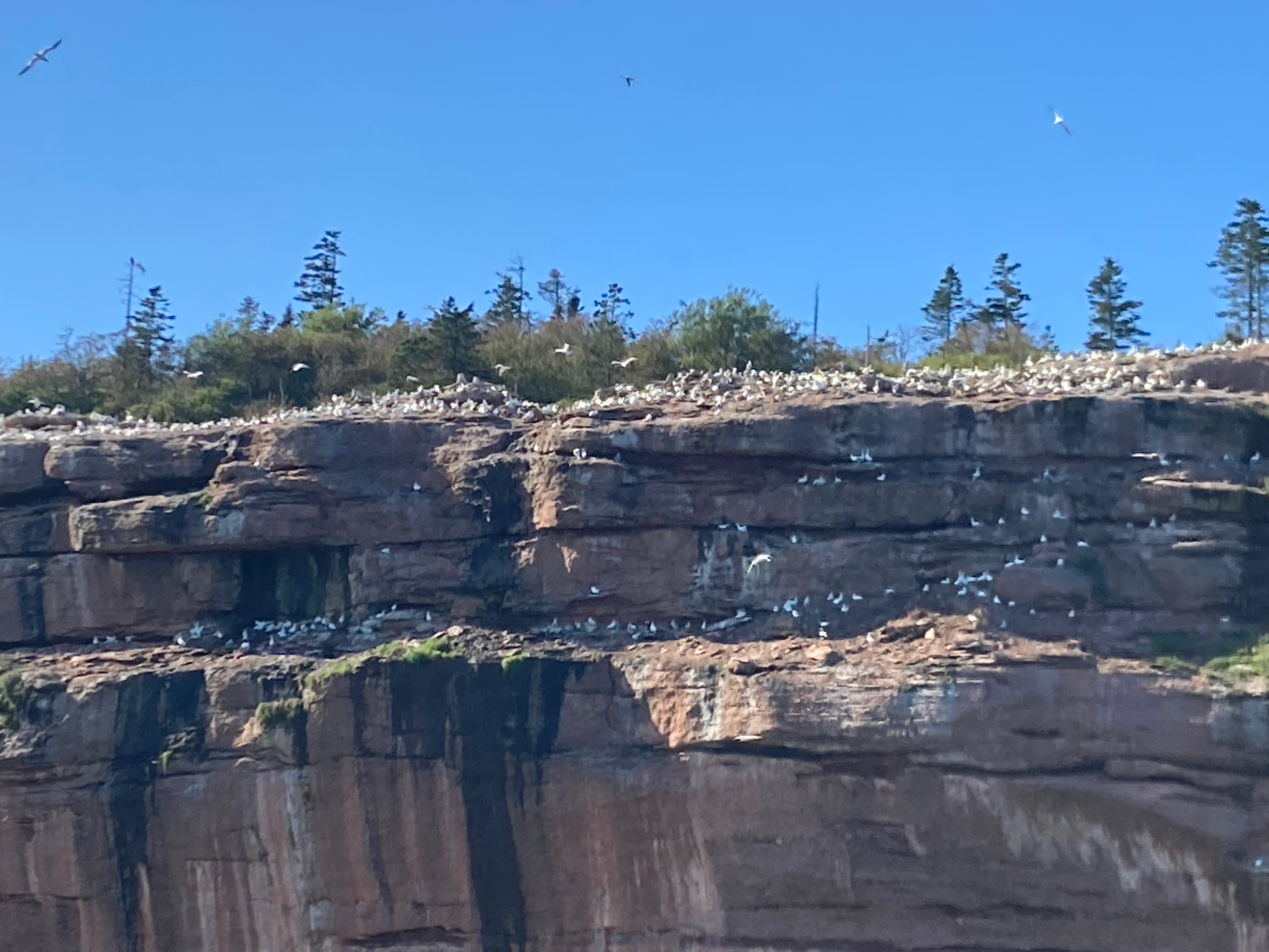
Next we went around Bonaventure Island which hosts a colony of 110,000 northern gannets. They filled the air. Fortunately none of them pooped on us.
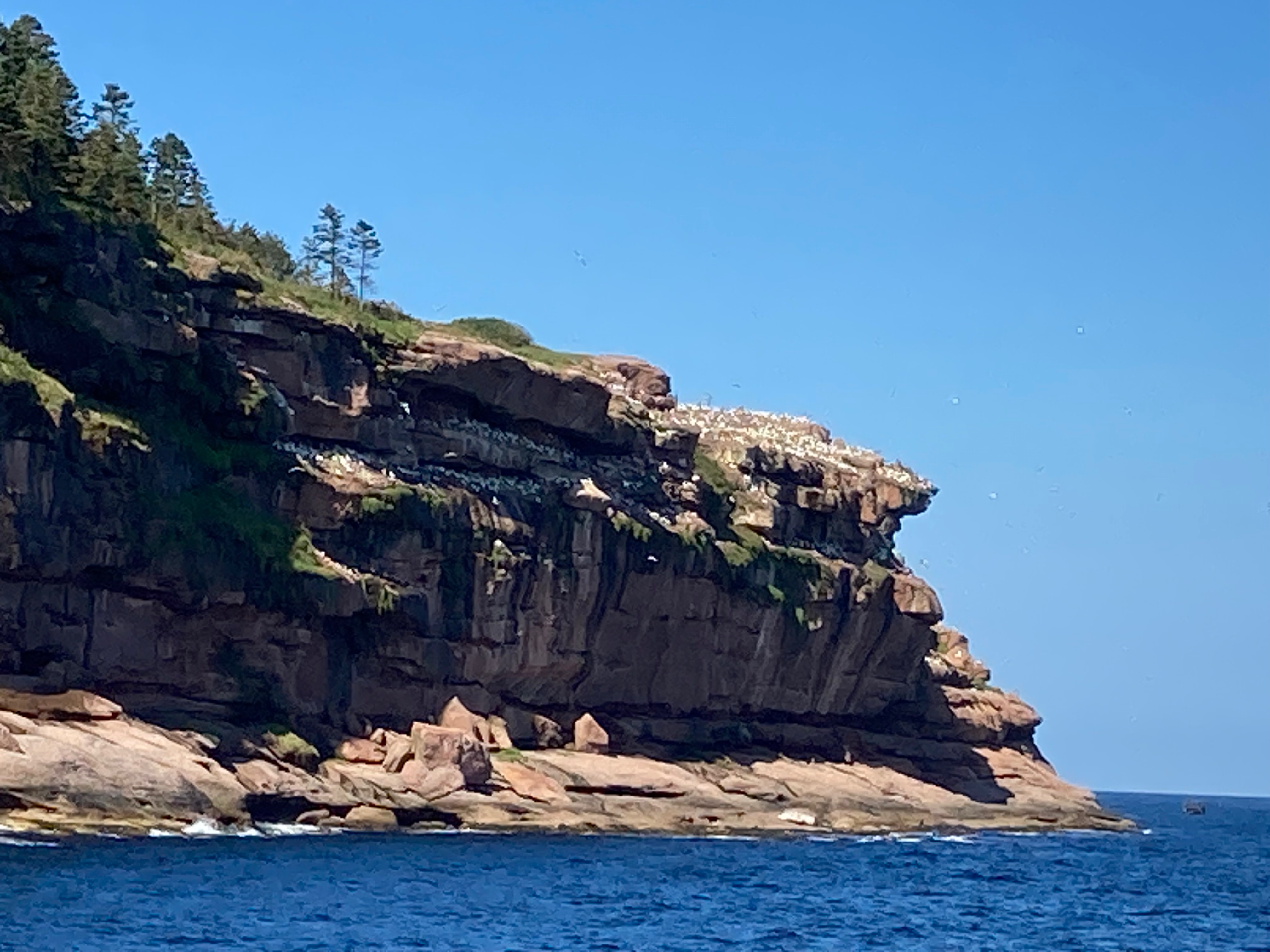

The boat docked to pick up people who had disembarked earlier. The island is a national park and I was curious about the houses, that I was told nobody lives in. In Forillon National Park there was a display about the people who lost their homes when the park was created in the 1970s. I wondered if the same thing happened here. In fact, throughout Canada you hear stories about the government moving people out of their villages, sometimes because the lifestyle has become unsustainable.
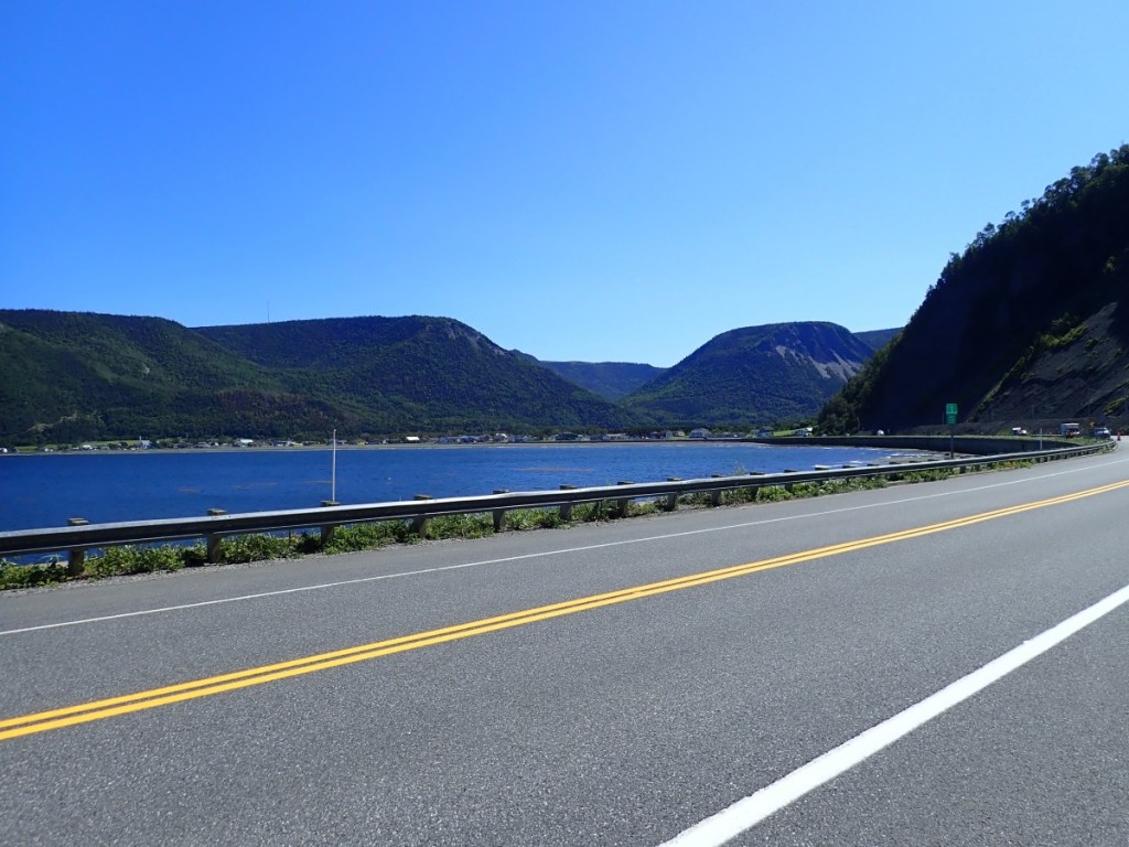
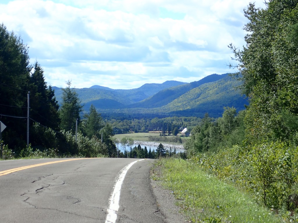
DAY 11 – August 29, Tuesday: 49 miles to Port Daniel-Gascons
The great thing about riding around the Gaspesie is, while there are hills, there are also long stretches of flat, fast riding. We had some of that this morning.
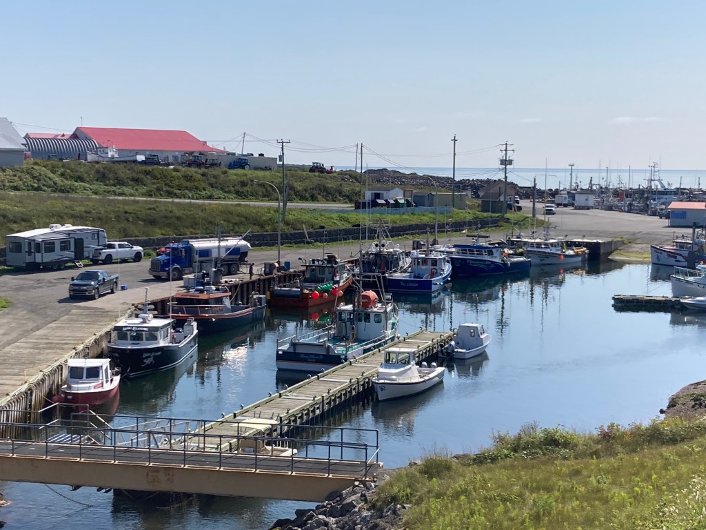
We had been wondering where the fishing boats were kept, as we’d learned that that was how people made a living. Today we found some when we stopped at a rest area. While there we talked to a trucker who told us that the largest lobsters get shipped to the United States.
DAY 12 – August 30, Wednesday: 51 miles to New Richmond
We started seeing the benches the day before; We even stopped to rest on one of them. Some were simply benches. Others were brightly painted – yellow or red – with beautiful flowers next to them. They were only on one side of the street, the side facing the water. When we stopped for a second breakfast I asked the server about them. She said they were just for people to sit and rest and look at the water.


Rob noticed them first. Every house had artwork above the house number sign on the street. After Rob pointed them out to me, I realized each house had a different landscape painting.
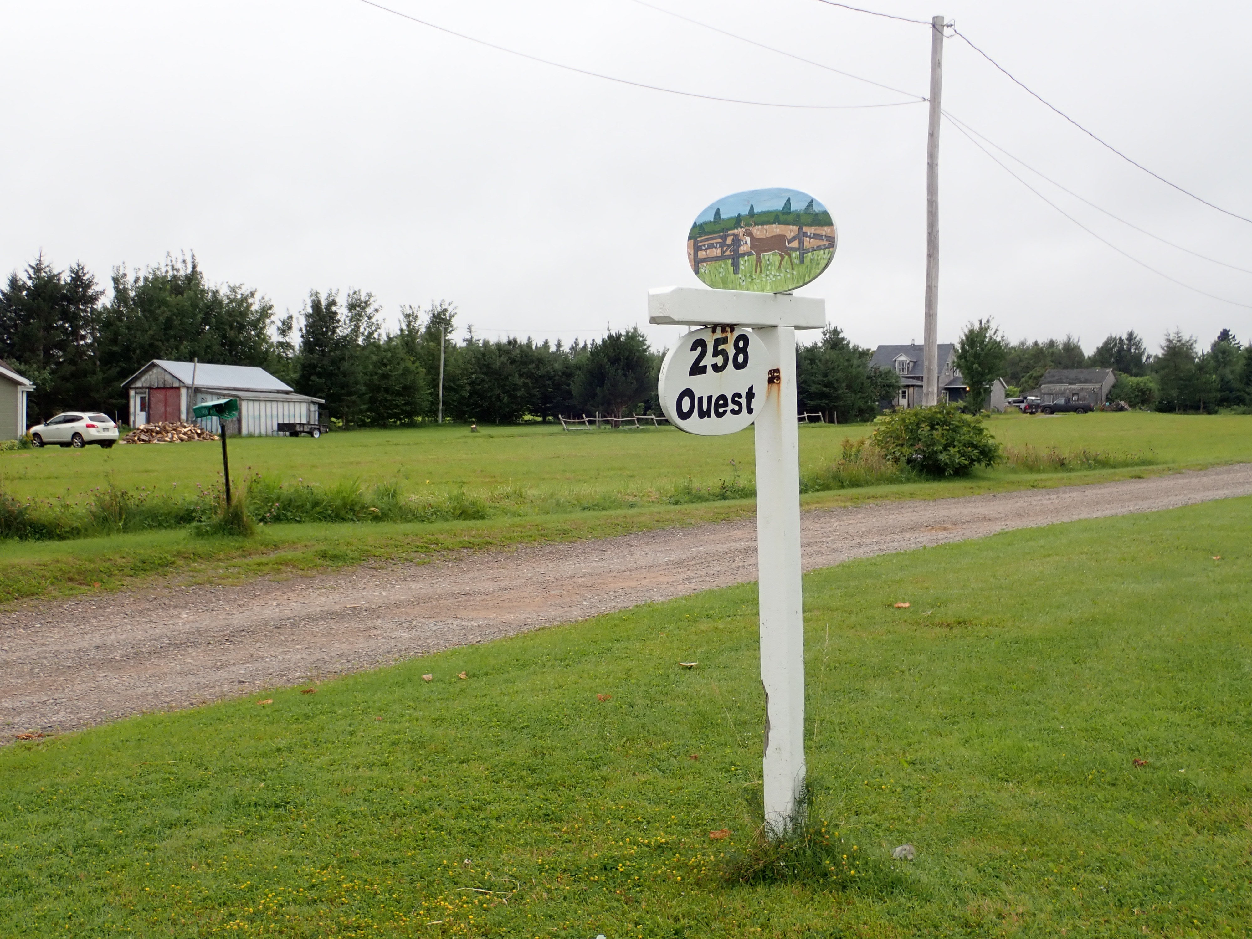
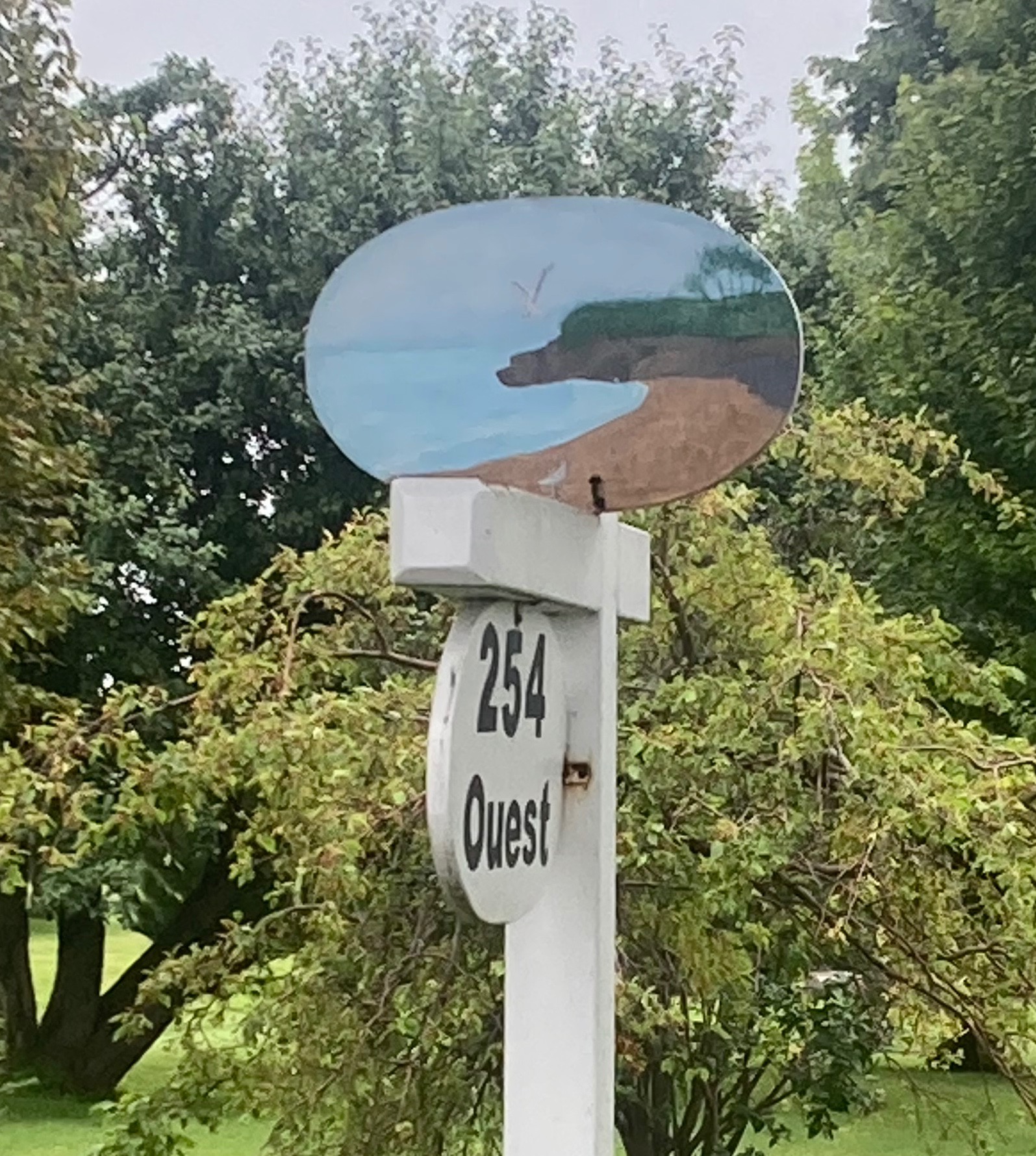
Our server told Rob that each town had a unique form of artwork. The next town would have bicycles and the next one fire hydrants.


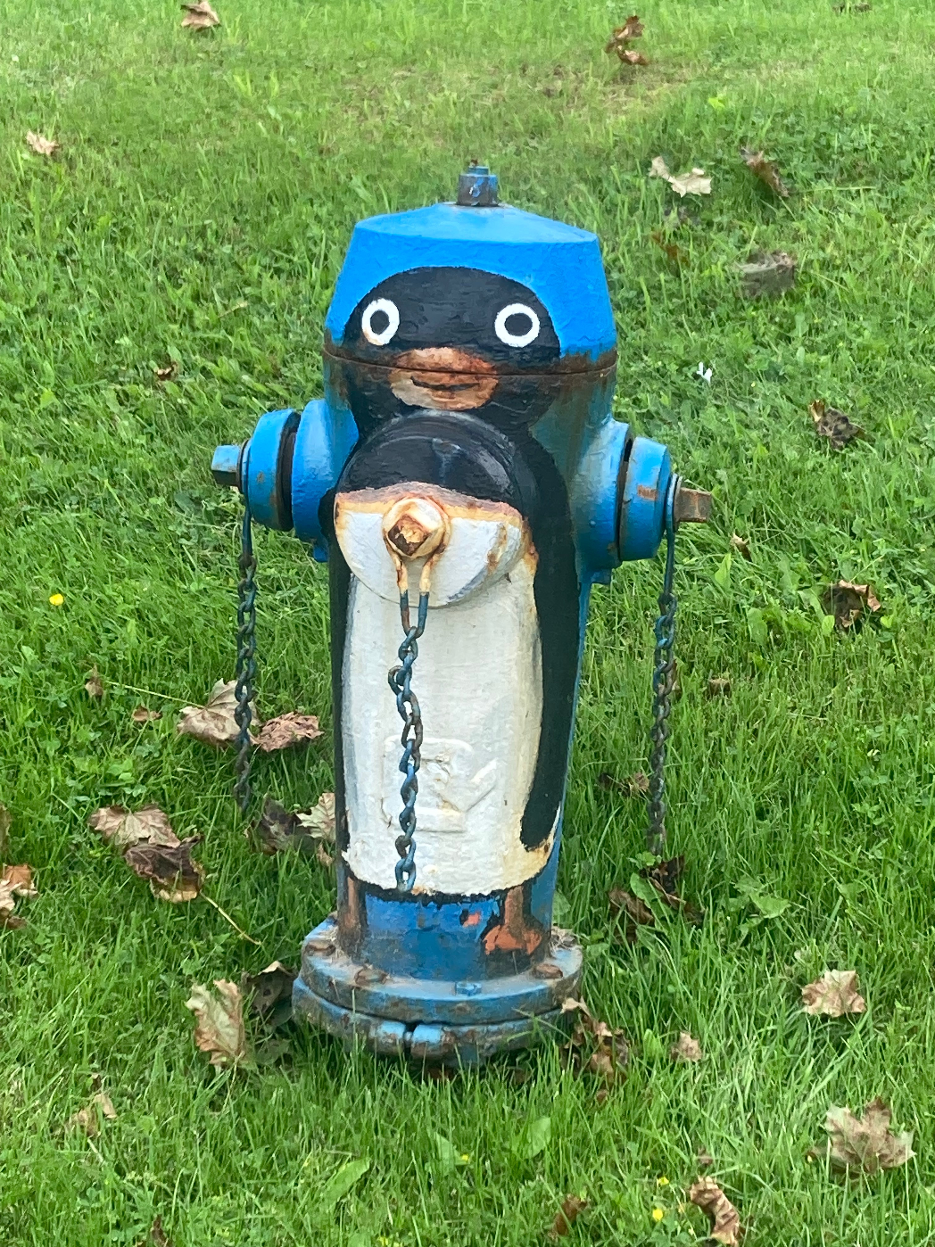
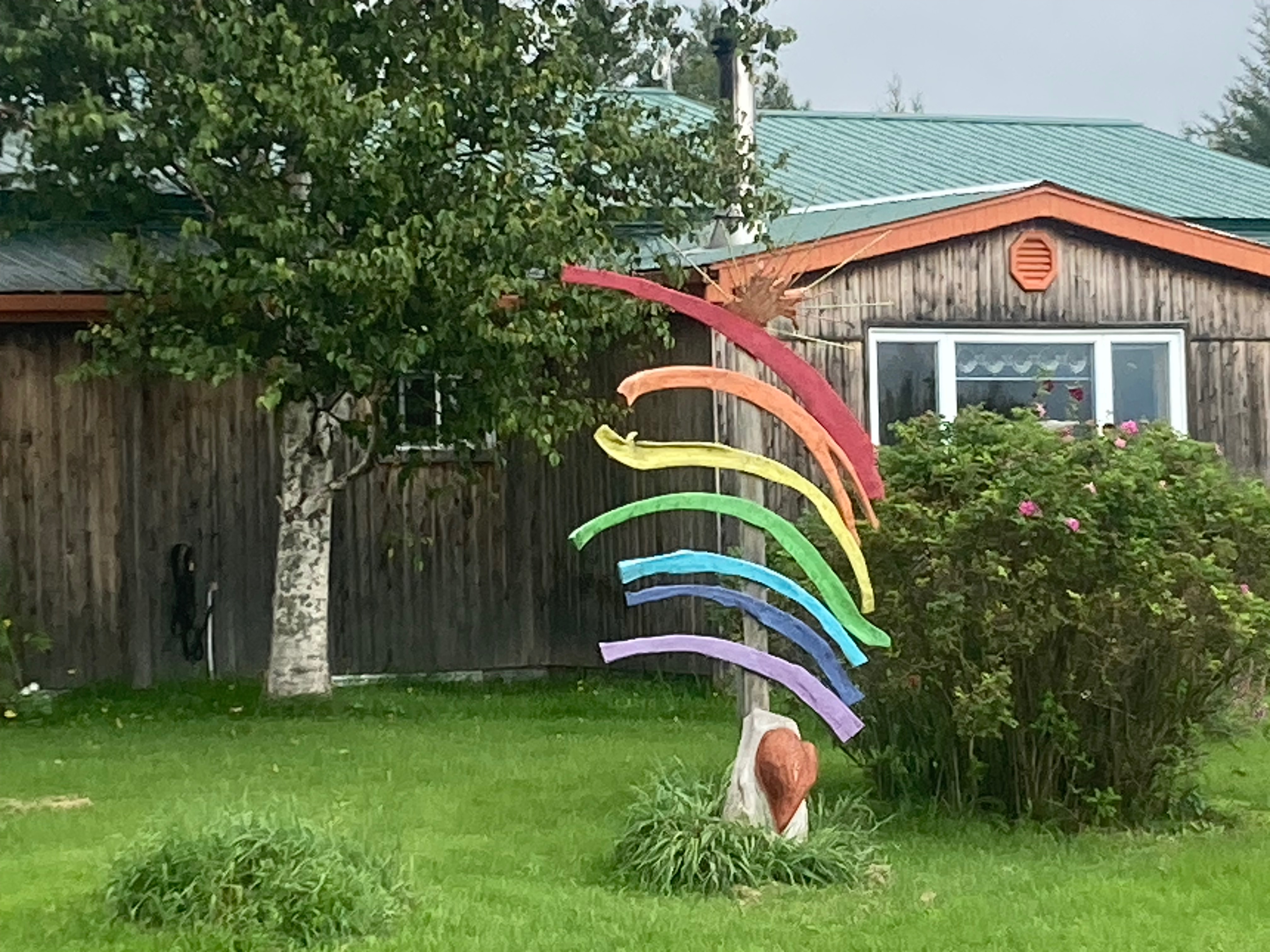
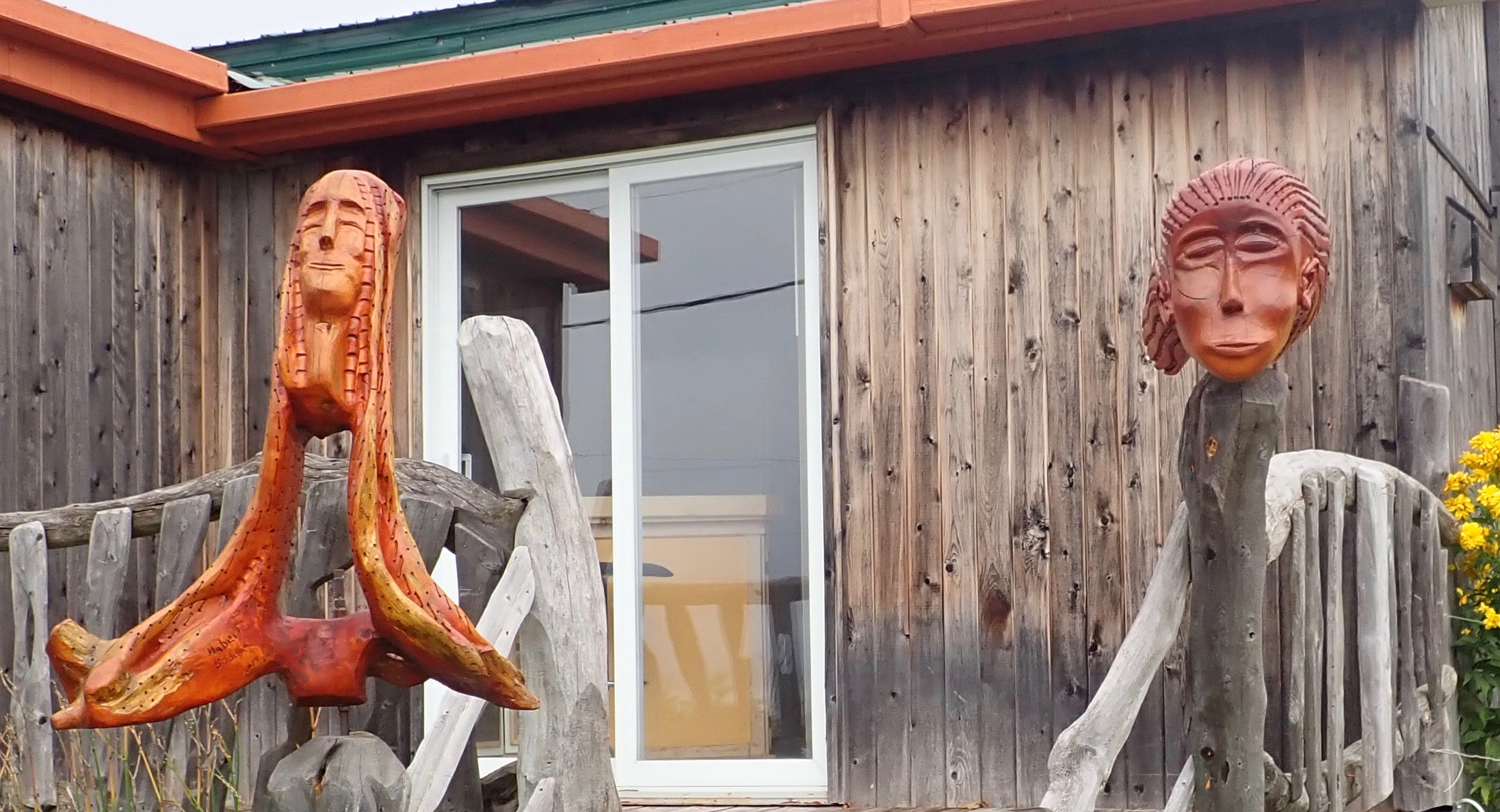
After the fire hydrants, we were cycling along and the sculptures in front of a house caught my eye.

When we stopped to take a closer look, I thought, of course this is an artist’s studio. I parked my bike and went around back to see if anyone was home. Sadly, no one was, but we saw a multitude of sculptures in back of the house. These are photos of the front yard.

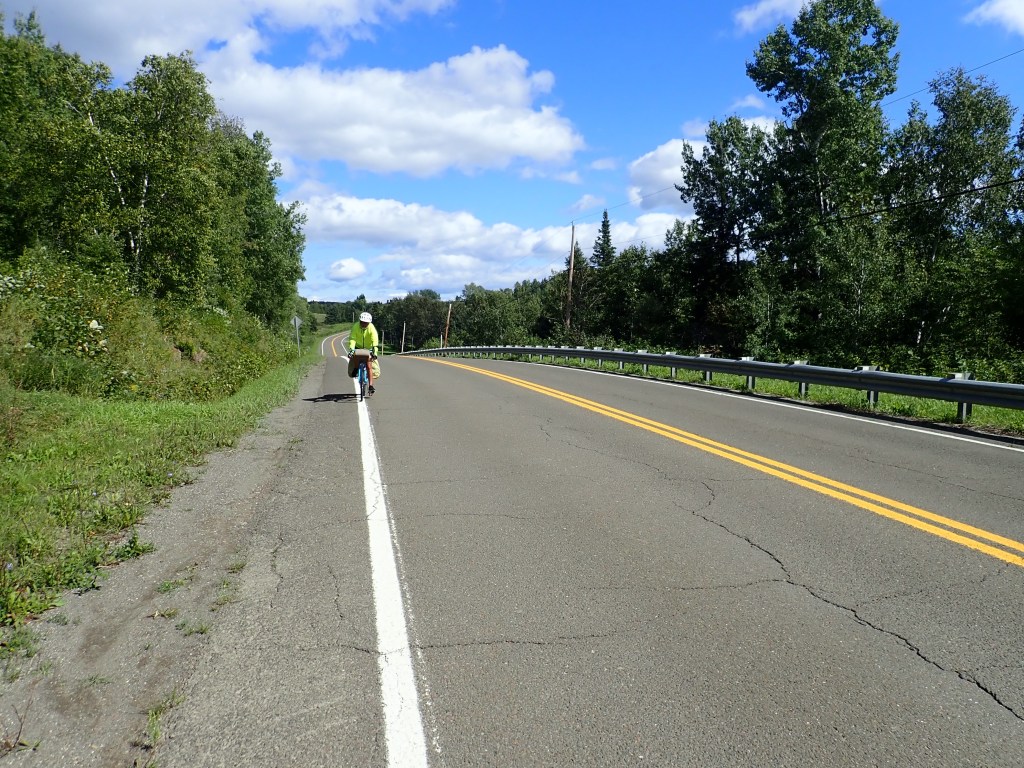
DAY 13 – August 31, Thursday: 61 miles back to Campbellton, New Brunswick
We arrived in New Carlyle through a park and came across a free mini-golf course. We were tempted, but it was windy and cold and we still had miles to go. We opted for hot drinks and a treat at a coffee shop instead.
We had plenty hills and beautiful scenery for our last day.

Thumbs up for a terrific – A+ – adventure.

One response to “Memorable Moments on the Gaspesie”
Connie, Thanks for taking us along. I’ve been enjoying the pics and the commentary. Hope to hear more about it this winter. Da
LikeLike