
The road that wraps around the Gaspee Peninsula is part of Quebec’s Route Verte, a network of bicycle routes throughout Quebec. Ever since Rob and I first heard about it, we’ve been wanting to ride it, but twice when we set our sights on it, a health issue got in the way. This had to be the year.
It promised to be one of the most challenging rides we would take on.
The following comes from https://www.tourisme-gaspesie.com/en/101/plan-a-cycling-tour-of-gaspesie/article.html:
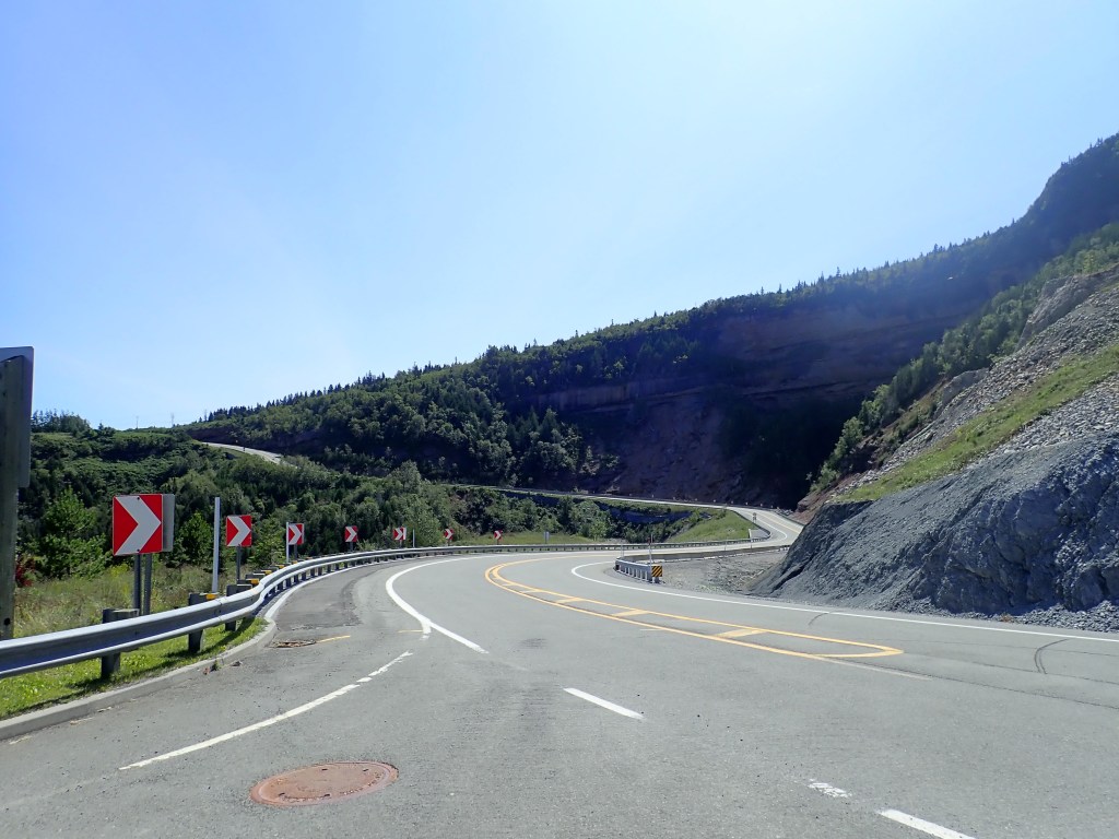
Note that Vélo Québec has identified nearly 40 hills with a grade of over 6% in Gaspésie, which means riding in this region will require you to be in good shape! The most significant ones are mainly found between Tourelle and Marsoui, between Sainte-Madeleine-de-la-Rivière-Madeleine and Rivière-au-Renard as well as in Forillon National Park and the Gaspé area. There are also hills as you approach Percé, in the vicinity of Port-Daniel, between Nouvelle and Escuminac (up to a 10% grade) as well as between Sainte-Jeanne-d’Arc and Saint-Octave-de-Métis.
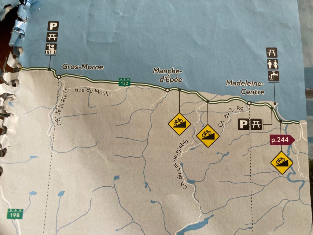
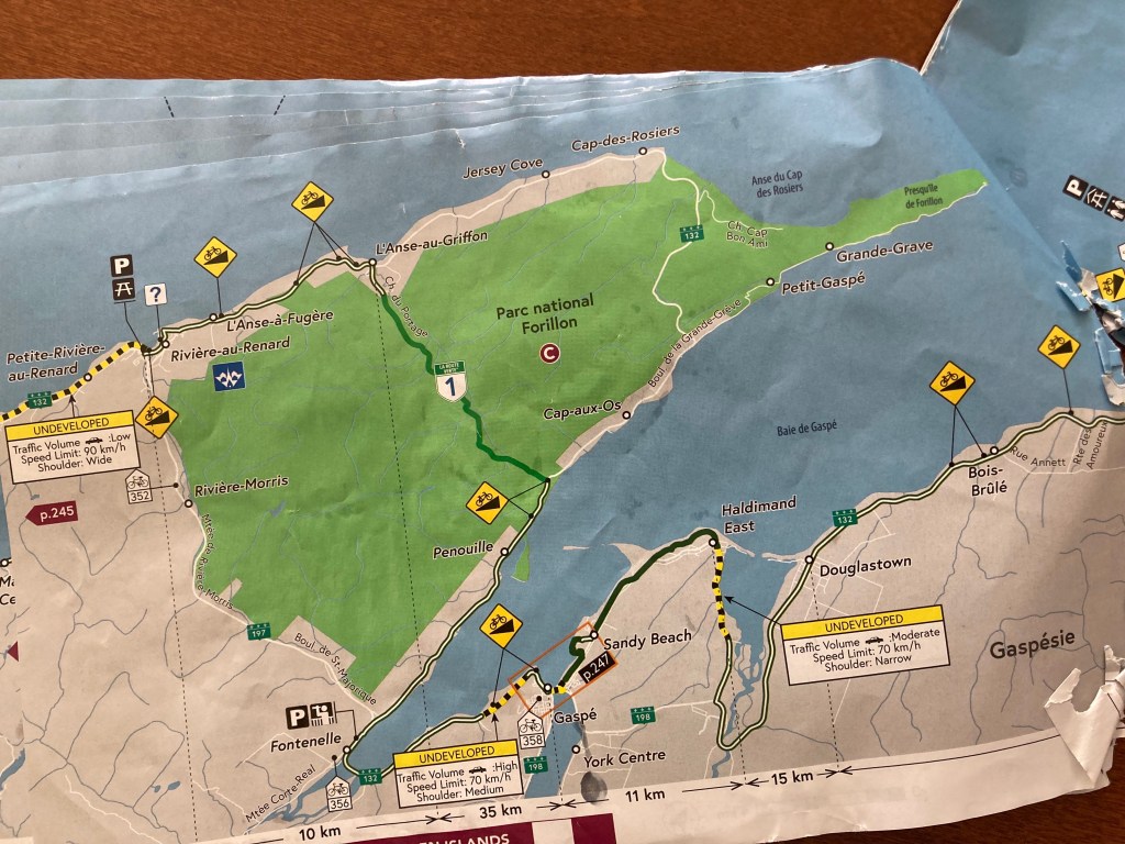
Read that paragraph carefully and you will get the impression that there are hills just about everywhere, every day. Following are the Route Verte maps of various sections. All those yellow symbols are hills, supposedly above 6%.


The paragraph that follows is no less intimidating:
Note also that some sections of Route 132 are not certified by the Route Verte because they don’t meet Vélo Québec’s safety criteria. For example, this is the case between Sainte-Madeleine-de-la-Rivière-Madeleine and Rivière-au-Renard. This segment of the highway (about 83 km) often doesn’t have a shoulder, has steep grades (up to 13%) and meanders between cliffs and the sea, making it unsafe for cyclists and thus not recommended. Fortunately, you have the option of using public transportation with your bike in this area.
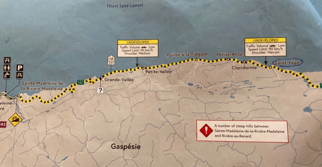
The “undeveloped” section is 66 kilometers. Yes, there is a bus. but you have to take two to skip riding the entire section and there is a 13 miles stretch that we would have to ride (or hitch) between the two buses. The buses don’t run on weekends and you need to make a reservation. To cover our bases I made a reservation for both buses, with our bikes. Cost was $4 and we didn’t have to pay in advance.
We wanted to make sure we were ready for this challenge. If we weren’t, we’d be miserable. I checked the elevation profile of the entire route using MapMyRide.com against the routes we were training on. I made sure we’d have at least a campground to stay every 35 to 40 miles and checked in with a few of them to make sure they’d have a site for us. And we trained hard, riding our hilliest local routes, ranging from 35 to 50 miles, for a total of over a hundred miles each week starting early in the summer. As our departure date became imminent, we rode with our bikes fully loaded with all our gear, which we pared down to be as light as possible. No folding chairs on this trip. And we switched from riding with cleated shoes to riding flat pedals, so no need for an extra pair of shoes.
Most of the literature recommended riding the peninsula in the clockwise direction in order to have tailwinds on the northern section where the hills are unrelenting. We decided to start by crossing the peninsula from south to north first where there weren’t too many hills to give us a few days to warm up. We were grateful to find a family through Warm Showers who let us leave our car with them in Campbellton, New Brunswick.
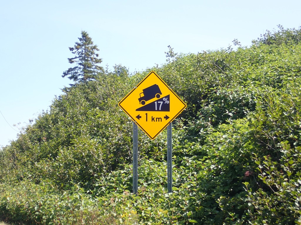
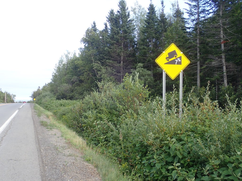
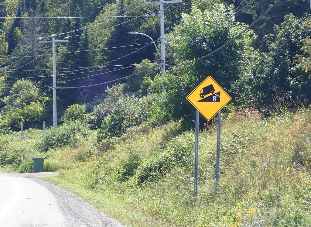
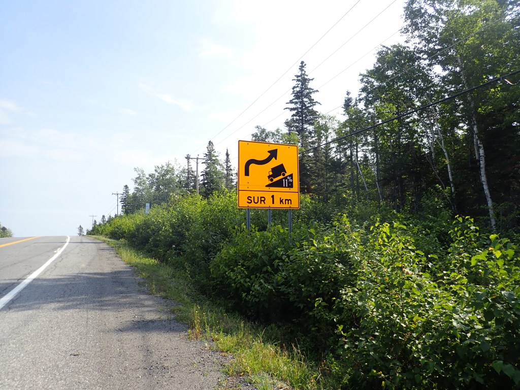
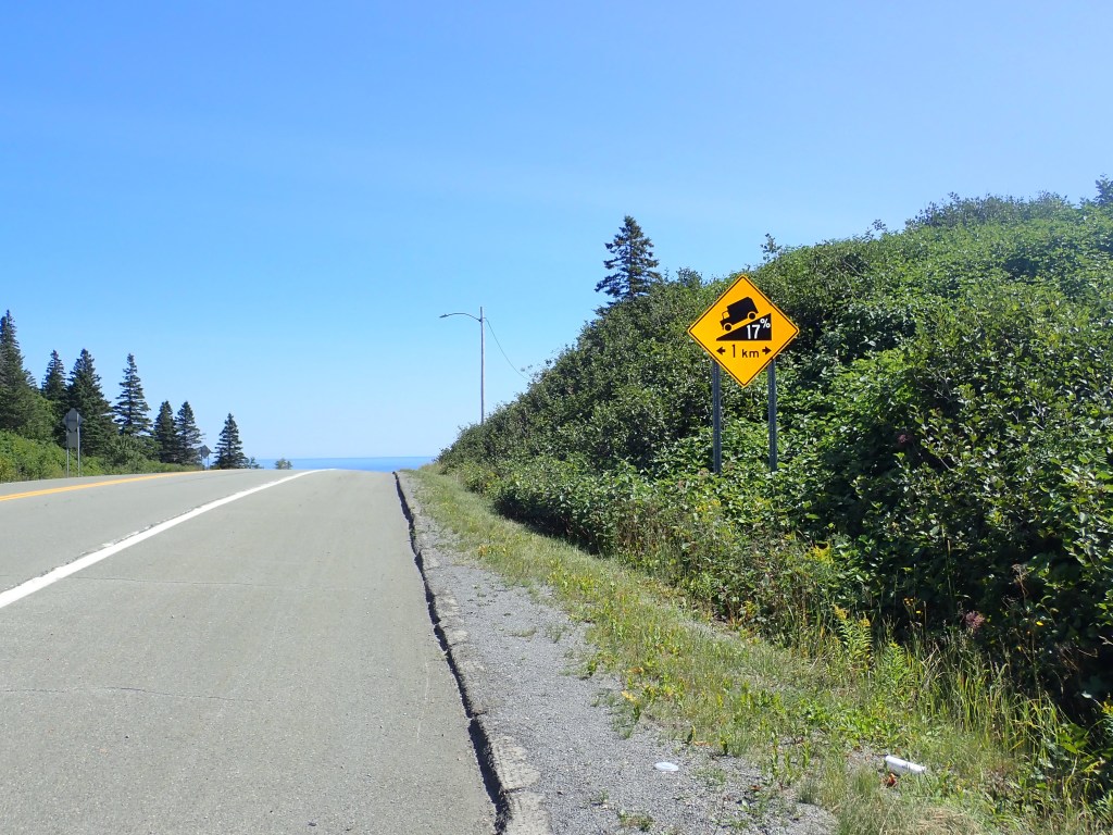
As the hills started coming, I began a collection of signs for every percent of steepness. Most of them indicated the hills we could anticipate going down. I only found a few indicating what we had climbed. I wondered if it was because I missed them or if we had just picked the easier way to go.
I had a tentative – very conservative – itinerary that had us doing between 14 and 44 miles a day. Our first day was supposed to be 42 miles. We did 56. Then a couple days later we combined three days of riding into two. Just before we started the “undeveloped” section where we’d hit all the steep hills, we rode 57 miles. Most days we finished riding before 4:00.
Until we arrived at the beginning of the “undeveloped” section, where we thought we might take the bus, none of the hills were insurmountable. By then, we were about three days ahead of schedule. We’d talked to several cyclists coming from the other direction and all of them said they’d had to tackle the hills with a headwind, but they had all ridden the entire section. It was definitely doable.
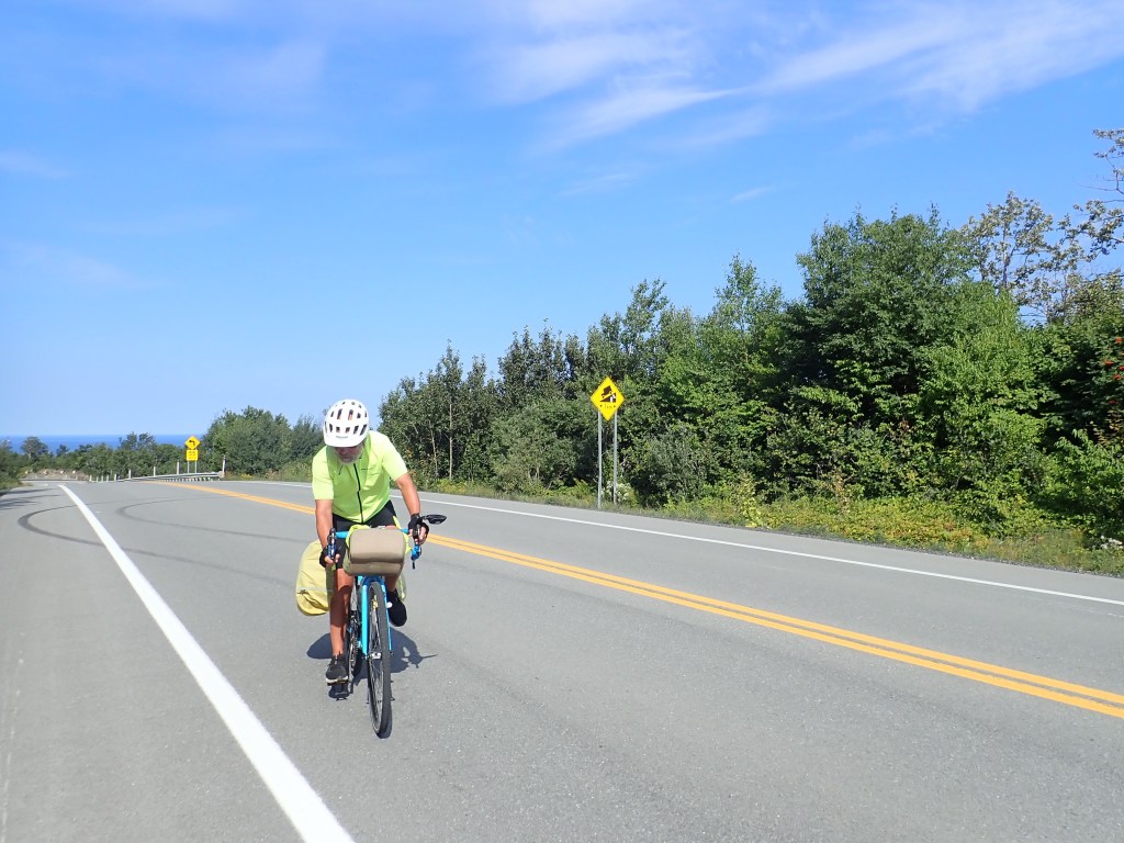
I told Rob I wanted to push ahead. If we took the bus we might miss some beautiful sections. We hadn’t yet met our match. Even given his lung disease, he’d been riding strong, never far behind me even on the hills. This was something I wasn’t willing to negotiate. Fortunately, Rob agreed.
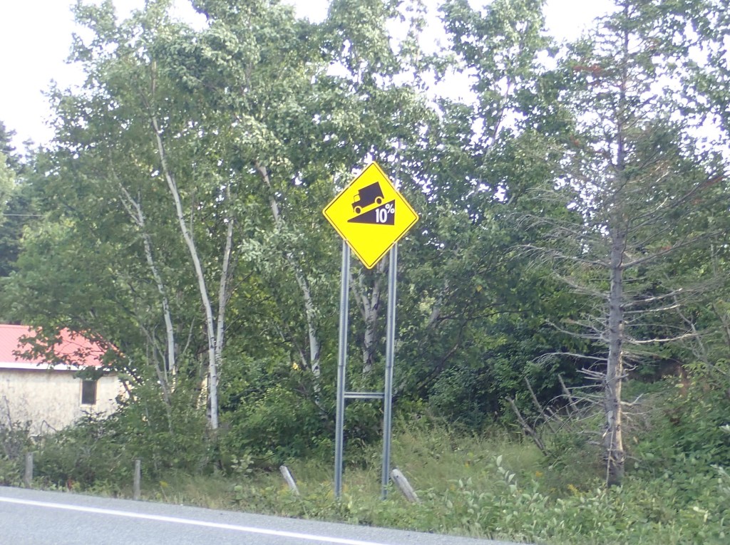
When we rode up a hill that was marked 10%, we both agreed that was our limit. Anything higher than that, we walked, at least on the steepest part.
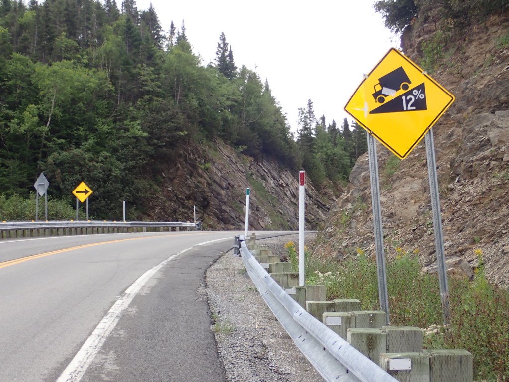


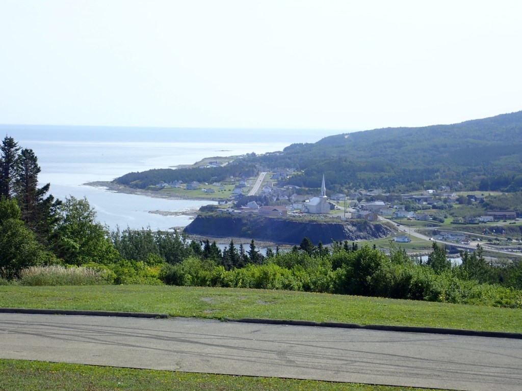
When we arrived at the overlook to Grand-Vallee I wrote in my journal, “Looks like we’re not going to take the bus. Just tackled the hills to Grand Vallee – even a 13% grade. We can do this. We’re not too proud to walk.” No matter how we got to the top, we still got to enjoy the ride down. And there were plenty downhill rides.
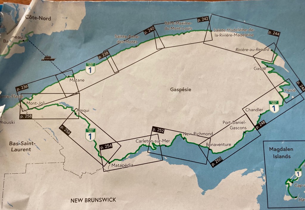
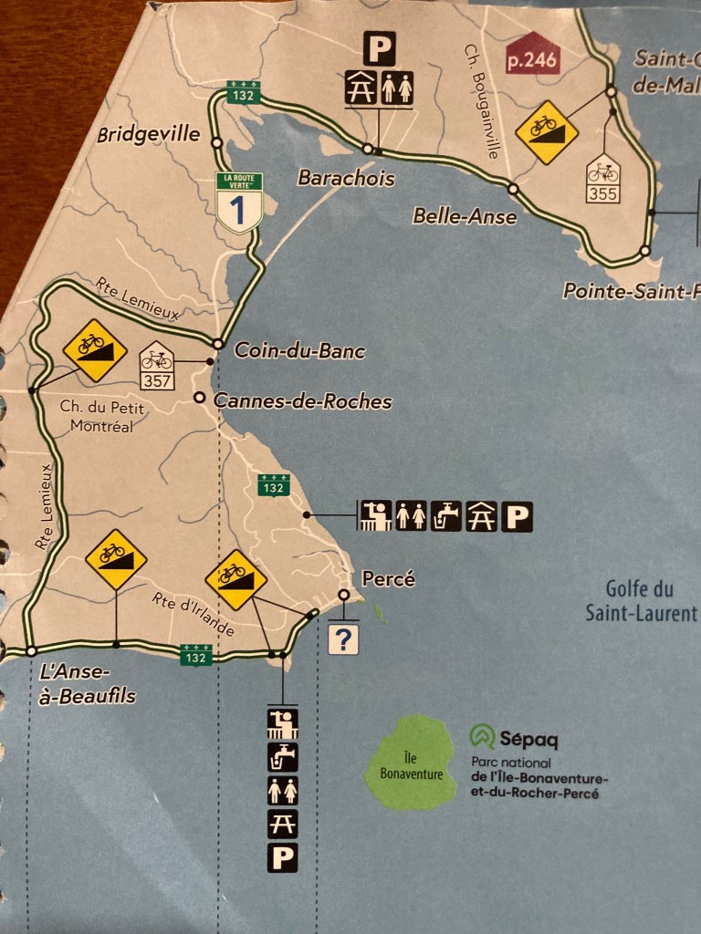
We were well past the concentrated steep hills on the northern shore of the peninsula and on our way to the town of Perce, where we’d see the famous Perce Rock. The Route Verte had us going a long way around and we thought, why not take the direct route? Below is the map. You can see where it might make sense to follow Route 132 – which we’d been riding along most of the time – and go directly to Perce that way. The other way is longer and there are still plenty of hills. When we arrived in the little town of Coin-du-Banc, we were able to find someone who spoke English and I inquired about the two possibilities. He told us that staying on 132 there would be less traffic, better views, and steeper hills. And it was obviously shorter.

That was on Day 10 of what turned out to be a 13-day trip. I had planned for 17 days.
Even the week before we left we wondered if we were nuts trying to tackle this ride. The Gaspee Peninsula promised to be one of the most challenging rides we would take on. It wasn’t. We had hills; we had rain; we had headwinds. But there was not a single day that matched any of the days we both agreed were our hardest days ever.
After a year with extraordinary pain resulting in a spinal fusion with a six-month recovery this trip was a gift. For Rob, with his pulmonary hypertension, my answer to the E-bike question was, “You don’t need an E-bike.” We nailed it!

3 responses to “HILLS!”
Hi, I met you while you were having lunch in Métis-sur-Mer. Wow, you did it all! Bravo! And you saw the Percé Rock, lucky you. It was so foggy when I was there that I could not even see it…;)
LikeLike
I remember. It was fun meeting you. And more pictures of Percé Rock will be coming in the next post.
LikeLike
A gazillion kudos to you two! A superbly impressive accomplishment! congrats!
LikeLike